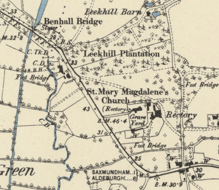
Parish: STERNFIELD
District Council: EAST SUFFOLK (previously Suffolk Coastal)
TM 309 541
Not open to the public
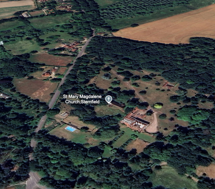
Formerly the rectory, Sternfield House (Grade II) is c. 1.6km (1ml) south of Saxmundham and stands at c. 10m above sea level in an area of sandy free-draining soil. To the west the River Fromus flows south before joining the River Alde and forms the boundary between Sternfield and Benhall parishes. A tributary of the Fromus flows through the grounds of Sternfield House.and the house is towards the western boundary of the parish. Part of the Hurts Hall Estate of Saxmundham is in the northern section of the parish. The Church of St Mary Magdalene (Grade II*) is immediately west of the house and has fourteenth century origins, most notably the porch and tower. With a complicated early history during which time it was owned by the Mandeville, de Pole (Earls of Suffolk) and Framlingham families, Sternfield manor was bought by Dudley North of Glemham Hall (Grade II) in 1719 and descended to William Evelyn North of Hurts Hall (Grade II) in Saxmundham.
RESIDENTS AND OWNERS
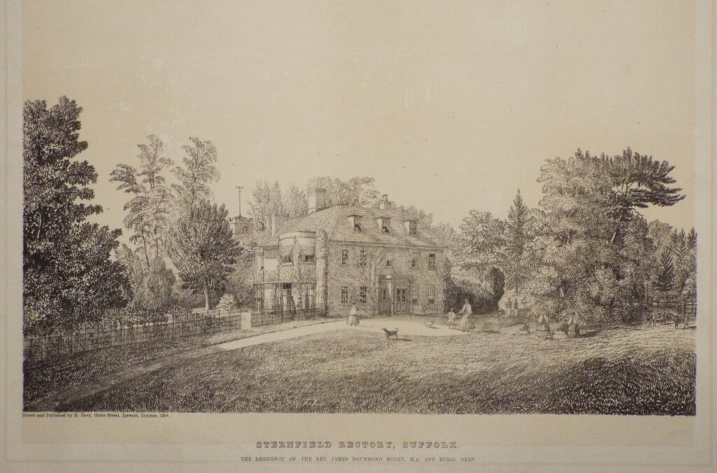
The Revd Montague North (1712–79) became rector of Sternfield in 1767 and died there in 1779. He was the son of the successful lawyer, historian and biographer Roger North (1653–1734) of Rougham Hall (Grade II) in Norfolk. By 1788 the rector was Revd William Long (1763–1835), a member of the Long family who owned the neighbouring Hurts Hall Estate. There followed the Revd James Drummond Money, who by the time of the tithe apportionment in 1840 was rector and living in Sternfield with his first wife Charlotte. Charlotte died in 1848 and James married Clara Maria Burdett whose mother was a member of the Coutts banking family. The caption beneath a lithograph of Sternfield Rectory by Henry Davy dated 1858 lists him as the resident and also rural dean. James Money died in 1875 and there followed a period when Sternfield was served by curates. In 1881 the Revd John Longe (1832–1916), son of Revd John Longe diarist of Coddenham, was rector and lived at the rectory with his wife, five children, including his eldest son the artist William Vernon Longe.
In 1924, after suffering considerable damage at the hands of the military who occupied the house during World War I, the Church Commissioners sold the rectory to Humphery Scringeour and during the 1930s the house was renamed The Glebe and rented out until it was once again requisitioned by the military during World War II. During this time it was used, with Hurts Hall, by Major-General Sir Percy Hobart while he tested, developed and trained his units in the use of his ‘Funnies’. These were a number of unusually modified tanks that operated during the war with an important role in the D-Day landings. After the war it was bought by Sir Arthur Penn, comptroller of the Royal Household, and subsequently inherited by Sir Eric Penn (1916–93), who also served as comptroller. Sir Eric and his wife Lady Prue (1926–2023), who worked for MI5 during the war, employed the architect Raymond Erith (1904–73) to make substantial alterations and additions to the house during the 1960s so that it was a house fit for a number of royal visitors, especially Princess Margaret and her family, but also the Queen Mother and the Queen. Sir Eric and Lady Prue were music lovers and friends of Benjamin Britten and Peter Pears. They were trustees of the Aldeburgh Festival and would often take the Queen Mother to concerts at Britten’s newly-built concert hall at Snape, which was opened by the Queen in 1967. In 1985 Sternfield House was for sale to include a staff annexe, gardeners cottage, outbuildings and c. 15.5ha (38.5a).
THE RECTORY
Built in the second part of the eighteenth century, the former rectory has two storeys plus an attic and is built of red brick with a tiled roof. It was probably built for the Revd Montague North, rector of Sternfield between 1767 and 1779. In the 1960s alterations to the house by the architect Raymond Erith for Lord and Lady Penn included remodelling of the south front to form a symmetrical façade that opened onto the garden. At the same time a garage court and pedimented entrance were added to the west and north.
THE PARKLAND
By 1838, when the tithe map was surveyed that accompanied the 1840 tithe apportionment, the rector of Sternfield had use of glebe land surrounding the rectory and church to the north, east and west for a small park of woods and pastureland. A dense plantation of coniferous and deciduous trees formed the northernmost area where it butted-up to the parkland of Hurts Hall. A more open section of what appears to be wood pasture. This was an area of grazing land dotted with individual trees or clumps that were traditionally periodically cut for fuel and/or for additional fodder for the livestock. Immediately north and east of the rectory the parkland was much more open and dotted with the occasional clump or freestanding tree. A wide shelterbelt of trees along the lane known as Church Hill to the west gave privacy to the house and gardens, with a narrow shelterbelt along a lane to the east. The main access drive was from Church Hill to the north-west. It passed through the parkland to arrive at the east elevation of the house before travelling to the lane to the east. Henry Davy’s 1858 lithograph shows the east entrance front of the house with the drive exiting an area of densely planted trees and shrubs and widening directly in front of the house. Here passengers could alight their carriage before the drive continued south-eastward where it was flanked by a metal fence separating the gardens to the west and a small area of parkland to the east.
THE GARDENS
The first known representation of the garden at the rectory is a drawing entitled ‘A Ground Plan and View of the Intended Gardens and Water-works and Building of Revd. Doct. Montague North of Sternfield … With an Estimate of the Charges by Henry Ellison’. The drawing is undated but is likely to be c. 1767 when Montague North arrived as rector of Sternfield. It shows two alternative proposals for the gardens, both with a rectangular kitchen garden bordered by a canal and surrounding walks. Comparing these drawings to the actual site shows the kitchen garden to be on the site of the present house, suggesting either the rectory had not yet been built or the drawing is meant to be illustrative and not taken literally. It is unclear if Ellison’s plans were executed. If they were, by 1838 there was no canal on the site, although a surviving almost-rectangular walled garden similar in shape to Ellison’s suggestion had been built on a slightly different site south of the churchyard, perhaps around the time Revd Montague North’s house was constructed to the east of the church.
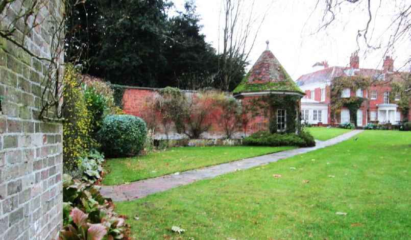
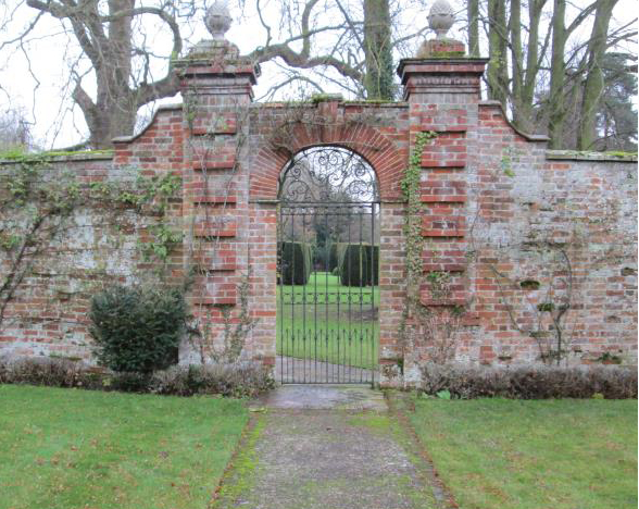
The 1838 tithe map shows an L-shaped ‘service’ corridor leading from the service wing beside the churchyard to the walled garden. This would have been used by the gardeners and servants of the house and was hidden from view from the pleasure gardens by a wall with a rectangular corner building within the corridor where the wall changes direction. This corridor arrived at a working area that was hidden behind the north wall of the walled garden where there was a path into the garden to join a number of other paths that divided the garden into four main sections. Today the corridor survives in an overgrown state and a red brick wall, possibly the original, also survives. By 1884 the rectangular corner building had been replaced by a surviving red brick hexagonal summerhouse on the pleasure garden side of the wall. By 2012 the walled garden was no longer used as a kitchen garden, the path layout had been simplified and the original gateways are believed to have been in-filled with a new ornate main entrance created between the walled garden and the pleasure grounds at a later date, perhaps as part of the alterations to the house and gardens during the 1960s.
In 1840 the southern pleasure grounds had a curved eastern boundary with a straight path from the south facade of the house that branched towards the walled kitchen garden or passed on as a walk beside an orchard. This layout appears to have survived until the Church Commissioners sold the rectory in 1924. Today the gardens to the south of the house have a more formal feel with hedged avenues turning at right-angles towards the east side of the walled garden, almost reflecting the geometric design produced by Ellison in the eighteenth century.
In 2025 the landscape setting of Sternfield House is threatened by the cumulative effects of proposed energy and infrastructure projects such as Sizewell C, Sealink and Lionlink and pipelines. Its present quiet village setting will be impacted by potentially three large convertor stations to the north-east at Wood Farm and substation for Sizewell C in Friston, the neighbouring village. The scale of the projects means severe disruption during the construction periods and severe visual impact on the setting of Sternfield House once the tall structures have been built
SOURCES:
BBC Radio Suffolk An Archive of WWII memories, submitted by Eileen Smy, 2005.
Birch, Mel, Suffolk’s Ancient Sites Historic Places, 2004.
Burke’s Peerage and Baronetage of the British Empire, 1865.
Copinger, W. A., The Manors of Suffolk: The Hundreds of Lothingland and Mutford, Plomesgate, and Risbridge, Vol. 5, 1909.
Jessop, Augustus (ed.), The Autobiography of The Hon. Roger North, 1887.
Kelly’s Directory, 1922.
Kelly, E., R., Suffolk. With Map, 1875.
Martin, Edward, ‘Garden Canals in Suffolk’ in Harper-Bill, C., Rawcliffe, C. and Wilson R. G. (eds) East Anglia’s History. Studies in Honour of Norman Scarfe, 2002.
Page, Augustine, Topographical and Genealogical, The County of Suffolk, A Supplement to the Suffolk Traveller (of J. Kirby), compiled 1811 and published in 1847 by Page, Joshua.
The Diary of John Longe (1765-1834), Vicar of Coddenham, Suffolk Records Society, published 2008.
The Gentlemen’s Magazine, 1829, 1835.
White, William, History, Gazetteer, and Directory of Suffolk…, 1844, 1855.
http://www.suffolklandscape.org.uk/landscapes/Rolling-estate-sandlands.aspx (accessed January 2019)
https://www.britannica.com/biography/Roger-North (accessed January 2025)
http://warfarehistorynetwork.com/daily/wwii/general-percy-hobart-britains-genius-tanker/ (accessed October 2019)
https://www.bbc.co.uk/history/ww2peopleswar/stories/50/a7160050.shtml (accessed October 2019)
http://www.benhall.org.uk/about/about-us/ (accessed January 2019)
https://www.brittenasaboy.com/news/lady-penn (accessed February 2025)
Census: 1841, 1851, 1861, 1871, 1881, 1901, 1911.
Hodskinson’s Map of Suffolk in 1783.
1840 (surveyed 1838) tithe map and apportionment.
1884 (surveyed 1882) Ordnance Survey map.
1905 (revised 1903) OS map.
1928 (revised 1925) OS map.
1949 (revised 1938) OS map.
1951 (revised 1945 to 1946) OS map.
2023 Google Earth
Heritage Assets:
Suffolk Historic Environment Record (SHER): SNF 010, SNF 030.
Sternfield House (Grade II), English Heritage No: 1231300.
Church of St Mary Magdalene (Grade II*), English Heritage No: 1278252.
Hurts Hall, Saxmundham (Grade II), Historic England No: 1268178.
Glemham Hall (Grade II), Historic England No: 1001461.
Rougham Hall, Norfolk (Grade II), Historic England No: 1169456.
Suffolk Record Office (now Suffolk Archives):
SRO (Ipswich) FC 132/C6/2, photocopy of conveyance of Rectory House of Sternfield and glebe of said Rectory, 3 March 1924.
SRO (Lowestoft) 1117/384/2, Sales particulars for Sternfield House (previously The Glebe).
Site ownership: Private
Study written: February 2025
Type of Study: Suffolk Gardens Trust Walled Kitchen Gardens Recording Group Survey, 2012 and Desktop
Written by: Tina Ranft
Amended:
