(previously known as Great Bevills Farm and also known as Bevills)
Parish: BURES ST MARY
District Council: BABERGH
TL 908 348
Not open to the public except certain days for charity and organised group tours
Overlooking the River Stour valley to the west, Great Bevills (Grade II*) sits on the steep valley side, sheltered by the wooded hills behind. The land is mainly gravel and clay, not the best quality for arable cultivation, although there are pockets of better quality soils. It is just north of the large village of Bures St Mary that straddles the river, the border between Suffolk and Essex. The western part of the village is known as Bures Hamlet, a parish in Essex. Sudbury is c. 7km (4.35mls) to the north-west.
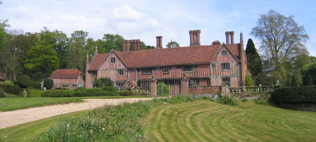
The timber-framed manor house is said by Historic England in its listing to have been built c. 1490 by Sir Richard Waldegrave of nearby Smallbridge Hall for his son, although another source believes it to have been Sir William Waldegrave in 1465. Described by Pevsner as a ‘spectacular house’, the original hall-house was extended over the centuries. Great Bevills continued to be occupied by the Waldegrave family until the first half of the eighteenth century.
For the next one hundred years it had a succession of owners and is thought to have become a large farmhouse during this period. In 1838 it was owned and occupied by a John Boggis and called ‘Great Bevills Farm’ on the tithe apportionment of that year. The accompanying tithe map marks fields such as ‘Upper Park Field’ and ‘Lower Park’ which suggest there was a park in the vicinity of the original fifteenth century house.
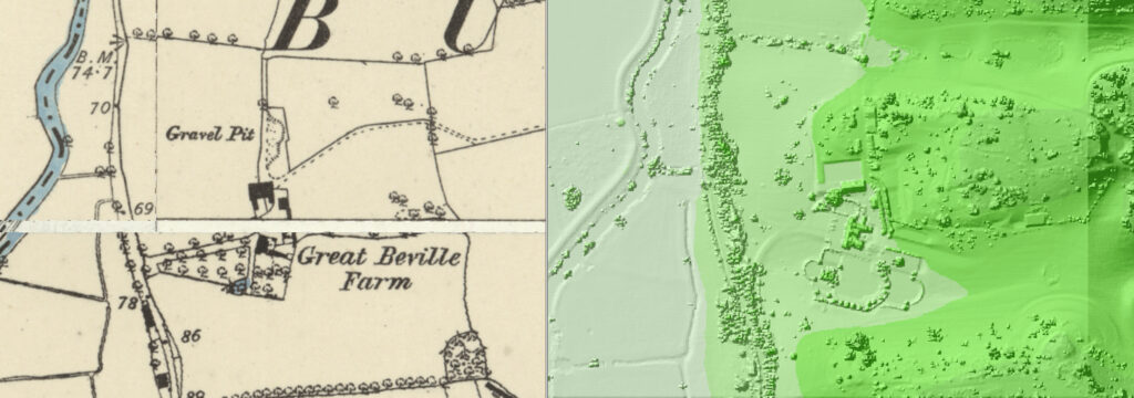
The house was extensively restored c. 1912–20 by Colonel William Probart, whose family bought the Bevills Estate in 1884. A year later the Great Bevills site is shown on the 1885 OS map to have had a single western entrance drive with an avenue of trees and an area of grass dotted with freestanding deciduous trees, possibly an orchard, to the south. When the drive reached the house it turned southward towards a pond. Another similar area of grass and trees was immediately south of the house. The site includes barns and outbuilding that sit behind the house to the north. One of the barns (Grade II) dates to the sixteenth century and was restored in 1923, soon after the work to the house.
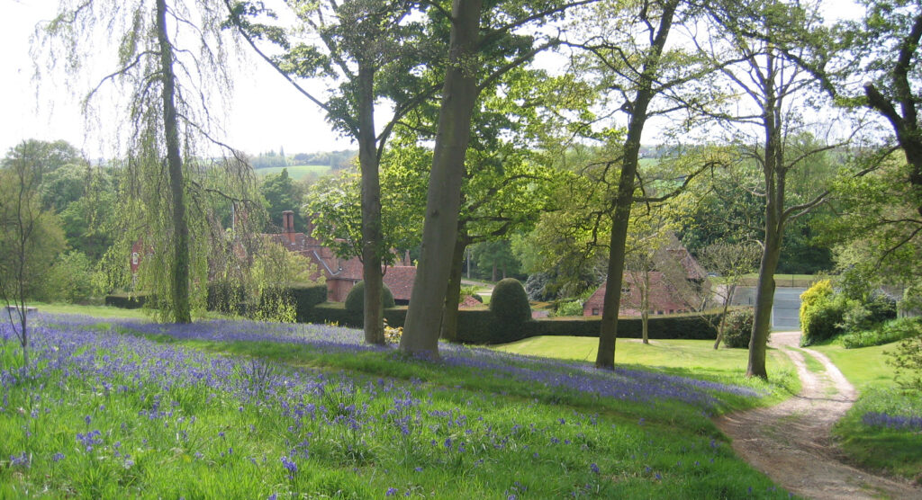
When William Probart arrived the estate was mainly bare sheep ground and he created over c. 16ha (40a) of woodland, which was added to by his grandson Lt. Colonel Richard Probert who developed a further six woods and copses. The estate continues to be managed for biodiversity including the creation of wetlands for wading birds and waterfowl, miles of new mixed hedging and replacement planting in the woods with deciduous species such as chestnut.
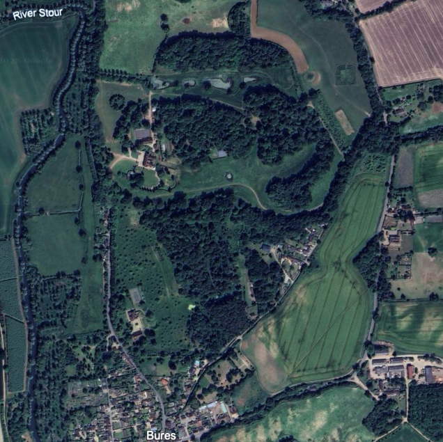
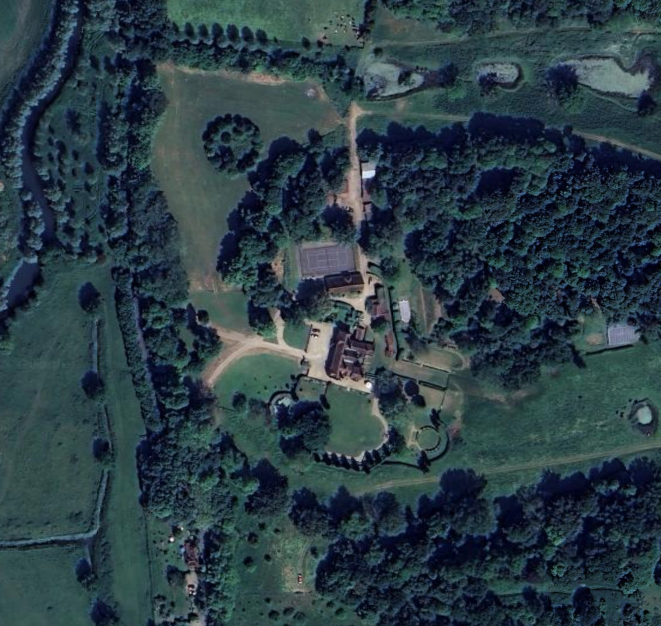
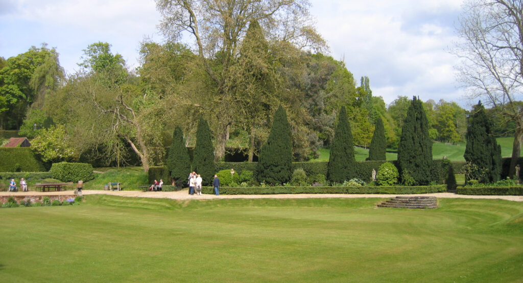
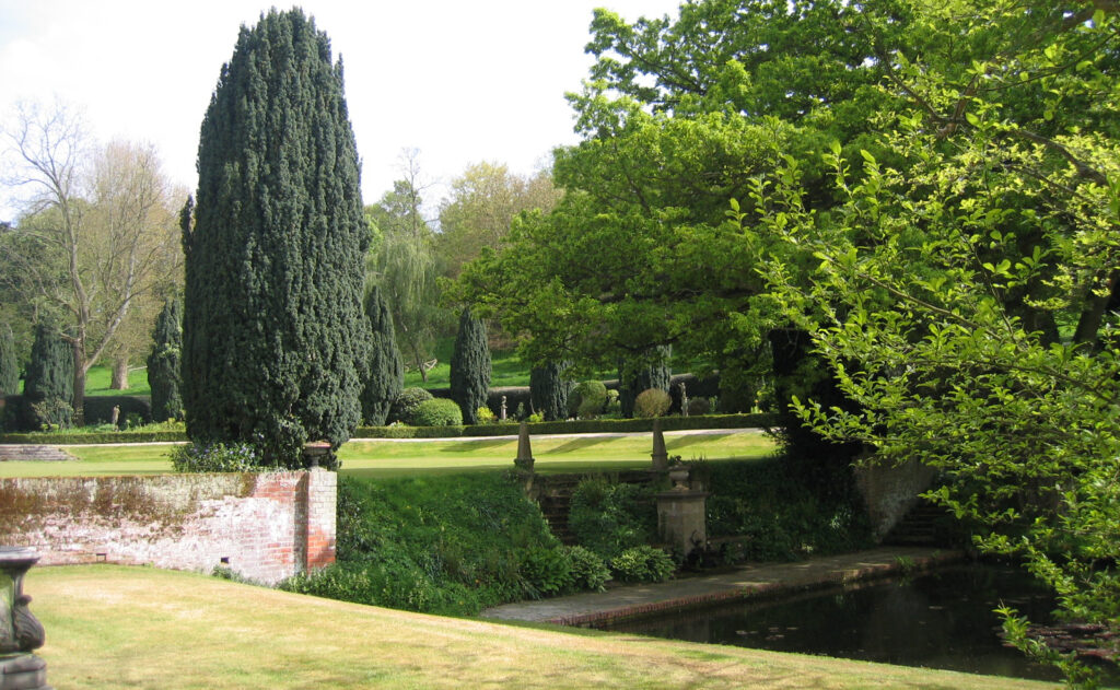
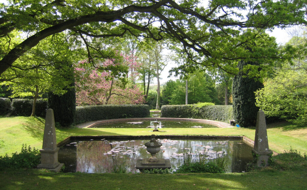
The Probarts also created Italianate-style gardens and terraces incorporating the existing pond in the valley south of the house. This began by creating two entrances from the west with drives that joined before arriving at the house. There followed the formalisation of the valley side into balustraded terraces with a bowl-like depression down to the existing pond, which was divided to form one square and one semi-circular pond. The formal planting consists of towering Irish yew, box-edged paths, topiary interspersed with stone ornaments. Further development of the gardens continued throughout the twentieth century, including the creation of a walled garden attached to the north-west corner of the house.
Great Bevills continues to be the home of the Probart family today.
SOURCES:
Alison Farmer Associates, Special Qualities of the Dedham Vale AONB, Evaluation of Area Between Bures and Sudbury, Final Report, July 2016.
East Anglian Daily Times, Bures: Farm manager at the Bevills Estate on restoring an ancient beauty, 7th June 2012.
Kelly’s Directory of Suffolk, 1912, 1937.
Pevsner, Nikolaus, The Buildings of England. Suffolk, 1961.
Sandon, Eric, Suffolk Houses, A Study of Domestic Architecture, 1977.
Suffolk Institute of Archaeology and History Excursions, Vol. 43, Part 2, 2014.
https://www.bures-online.co.uk/Waldegrave/bevills.htm (accessed January 2026).
Census: 1911.
Maps:
1838 (surveyed 1837) tithe map and apportionments.
1885 (surveyed 1885) OS map.
1905 (revised 1902) OS map.
1925 (revised 1920) OS map.
Heritage Assets:
Suffolk Historic Environment Record (SHER): BSM 108.
Great Bevills (Grade II*), Historic England No. 1036684.
Barn to north of Great Bevills (Grade II), Historic England No. 1351769.
Suffolk Archives (previously Suffolk Record Office):
(SA) HD 526/25/8. Papers of the Revd Edmund Farrer, photographs of Bevills, undated.
Site ownership: Private
Study written: January 2026
Type of Study: Desktop and site visit 2009
Written by: Tina Ranft
Amended:
