Parish: NON CIVIL PARISH (previously in Sproughton parish)
District Council: IPSWICH BOROUGH COUNCIL
TM 138 439
Historic England’s Register of Parks and Gardens of Special Historic Interest (Grade II)
Park and pleasure gardens open to the public
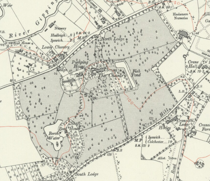
On the south side of the Gipping valley and c. 3km (1.9mls) west of the centre of Ipswich, Chantry Park (Grade II) was once in the parish of Sproughton but now on the south-west fringe of the Borough of Ipswich. Like a number of landscape parks in Suffolk, it was originally established during the eighteenth century to be within easy reach of a prosperous urban centre. Also known as Sproughton Chantry, The Chantry (Grade II) mansion sits in a gently undulating landscape that falls to the north, west and east allowing views from the west park over the Gipping valley to the north. Today the c. 50ha (124a) park is the largest public open space in Ipswich and features a number of trees of great age, some of which predate the present layout dating from the mid-nineteenth century, and wildlife areas.
OWNERS OF CHANTRY PARK
In 1509, when the land was used for open grazing, Edmund Daundy, a wealthy merchant, donated the site to St Lawrence Church for a chantry. It was suppressed with other Ipswich priories in 1536 and afterwards the Cutler family lived in a house on the site. By 1688 Sir Peyton Ventis owned the land and was succeeded by his son Edmund who built a house c. 1700 that is thought to form the foundation for the present mansion. After Edmund’s death in 1740 the Chantry Estate was sold to Sir John Barker and then in the 1770s to Metcalf Russell, both making major alterations to the house. The estate passed to Russell’s elected heir, Michael Collinson, whose son Charles enlarged and from 1795 developed the structure of the landscape park.
In 1836 it was bought by Charles Lillingston, who was married to the daughter of the Revd Fonnereau of Christchurch Mansion. Charles had made some changes to the house and park, but it is Sir Fitzroy Kelly, lawyer and MP for Ipswich and the new owner of the Chantry Estate in 1852, who is said to have made substantial alterations that give the mansion its ‘Italian’ style. He also added a new lodge and gates at the north entrance (Grade II) and created the formal garden to the south of the mansion. Once more up for sale, Chantry Park was sold to Charles Binney in 1867 and then to Sir Henry Domville by 1897. In 1906 Mrs Jump was the new owner and stayed until 1927 when it was sold to George Gooday, whose intention was to develop houses on the site. Sir Arthur Churchman, JP and member of Ipswich Council, intervened by buying the mansion and park and presenting it to the people of Ipswich as a public amenity that opened in 1928. The Chantry mansion was first used as an International Friendship Centre and after World War II as a convalescent and nursing home. It is currently a Sue Ryder neurological care centre.
THE CHANTRY
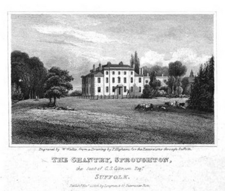
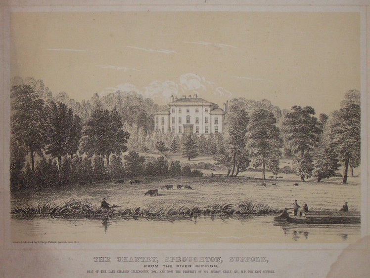
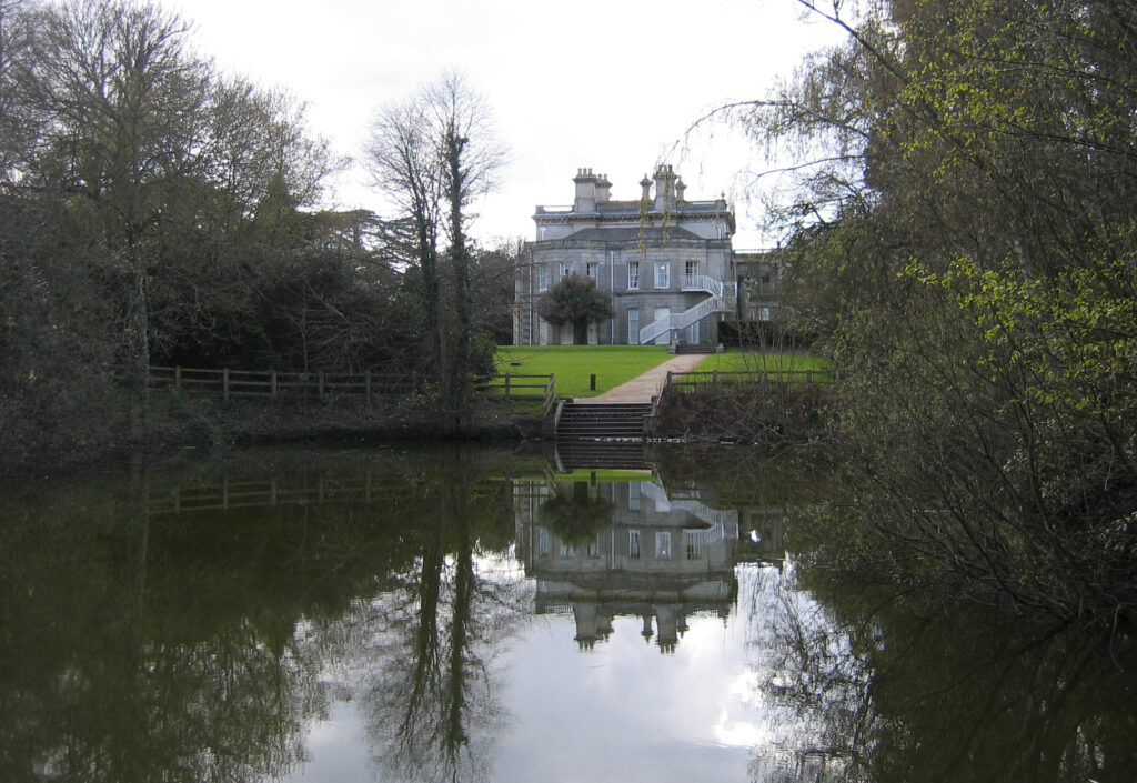
John Barker made changes to Edmund Vendris’s original c. 1700 house, but the character of the Chantry mansion is mainly eighteenth century, the result of substantial alterations during the latter part of that century by Metcalf Russell and the Collinson family. Engravings dated c. 1819 and c. 1829 show the north elevation of a central three-storey building topped by a parapet with a small central porch and two-storey wings to east and west. A large conservatory attached to the east wing, which was demolished in the 1930s, is said to have been added by Charles Collinson. Not shown on the c. 1829 engraving, this conservatory appears to have been built between 1830–36, before the estate was sold to Charles Lillingston.
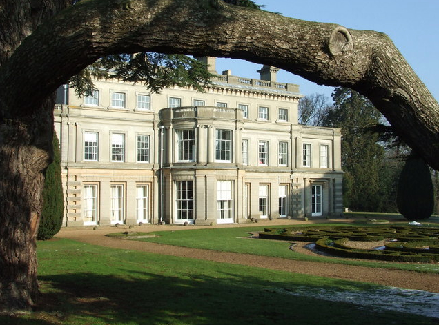
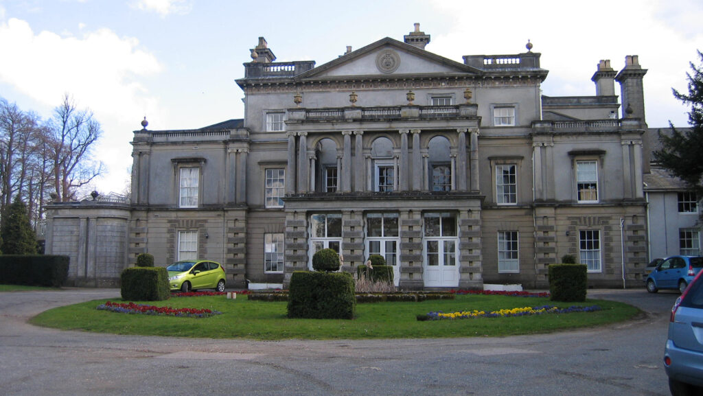
From 1852 Sir Fitzroy Kelly substantially remodelled the house in the Italianate style, which dominated country house design from the 1840s to 1860s. To the north elevation this included adding a two-storey porch with Palladian arches through which vehicles could pass (porte-cochére), the ground floor having since been glazed. By 1886 a walled entrance or carriage court had been added with a central lawn and circular drive. The addition of a central fountain pond is attributed to Mrs Jump – the pond survives but not the fountain. Sir Fitzroy also added a large two-storey bow to the south (garden) front, changed all the windows to double-hung sashes, altered and extended the east and west walls and faced the entire building in imitation Portland stone.
To the west of the mansion lies the service areas comprising Charles Collinson’s late-eighteenth century stables and coach house – the clock tower of the stables can be seen on the c. 1819 engraving – and a courtyard and walled garden complex. In the early-twentieth century Mrs Jump had the coachman’s living quarters converted to a chapel.
CHANTRY PARK
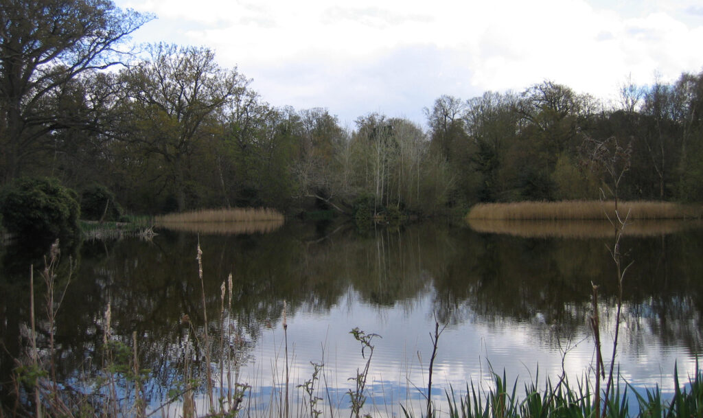
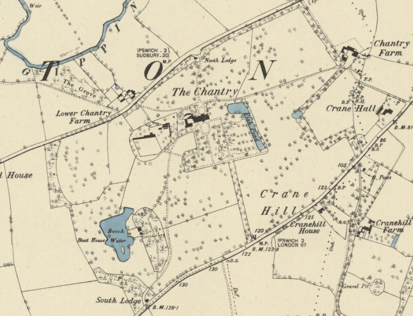
When owned by Metcalf Russell, Hodkinson’s 1783 map shows Chantry Park extending down to the River Gipping with the Ipswich to Hadleigh road running through the park to the north of the mansion. The park was bounded on the south by the present London Road, historically known as Crane Hill. The map also shows the main winding drive, now called Cricket Pavilion Drive, off Crane Hill from the south-west, passing a large irregularly-shaped lake in the lower part of the park, today known as Beech Water.
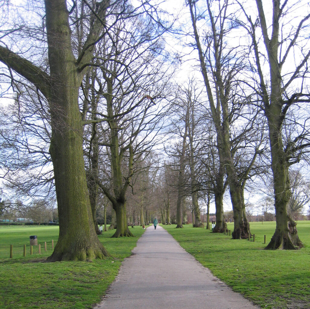
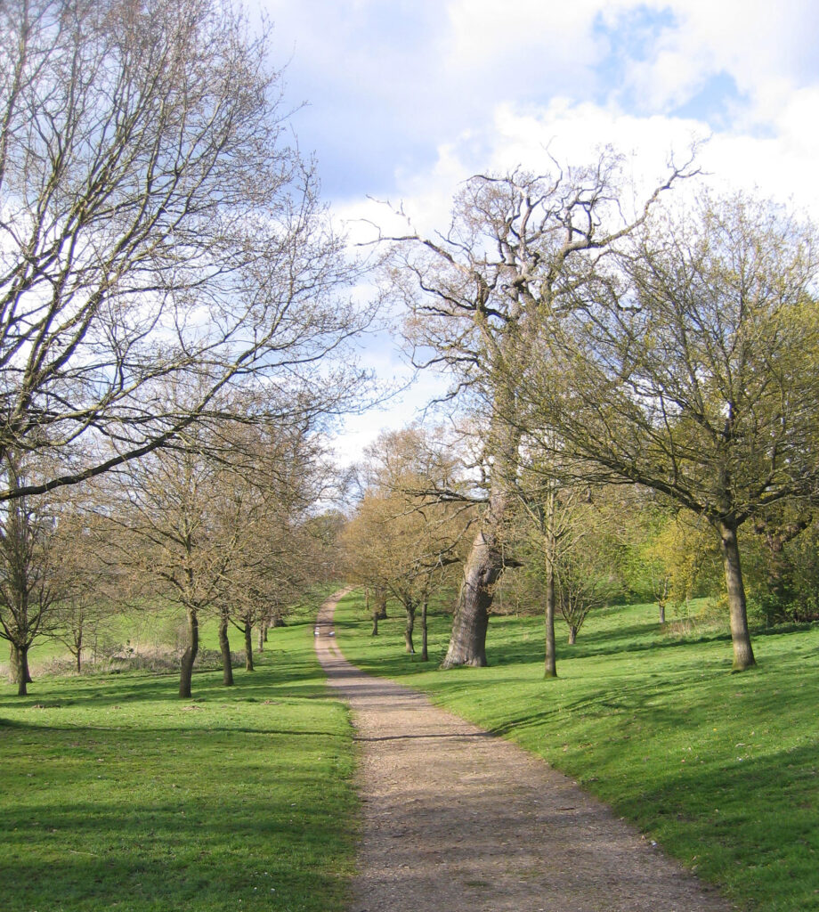
From 1795 onwards Charles Collinson enlarged the estate to c. 208ha (500a) and developed much of the present structure of the landscape park in the fashionable Picturesque style, similar to that used by Humphrey Repton. Some shelterbelts were established to the northern and southern boundaries. In 1807 Charles planted a new dramatic south avenue of limes, now known as Lime Avenue, which is centred on pleasure gardens to the east of the house and runs directly to the London Road. It still dominates the park today.
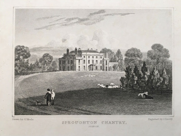
An engraving by T. Higham dated c. 1818 of the north elevation of the mansion shows a fence close to the house front and separating it from the surrounding parkland. However, over the next decade Charles Collinson removed the fence to open-up the front of the house to the parkland beyond and created a sweeping semi-circular in-and-out drive off the Hadleigh Road, shown in an engraving by John Preston Neale date c. 1829. In Jones and Co., Views of the Seats, Mansions, Castles, Etc. of Noblemen and Gentlemen in England, Wales, Scotland and Ireland the road was described as being concealed by a ‘sunk fence’ or ha-ha.
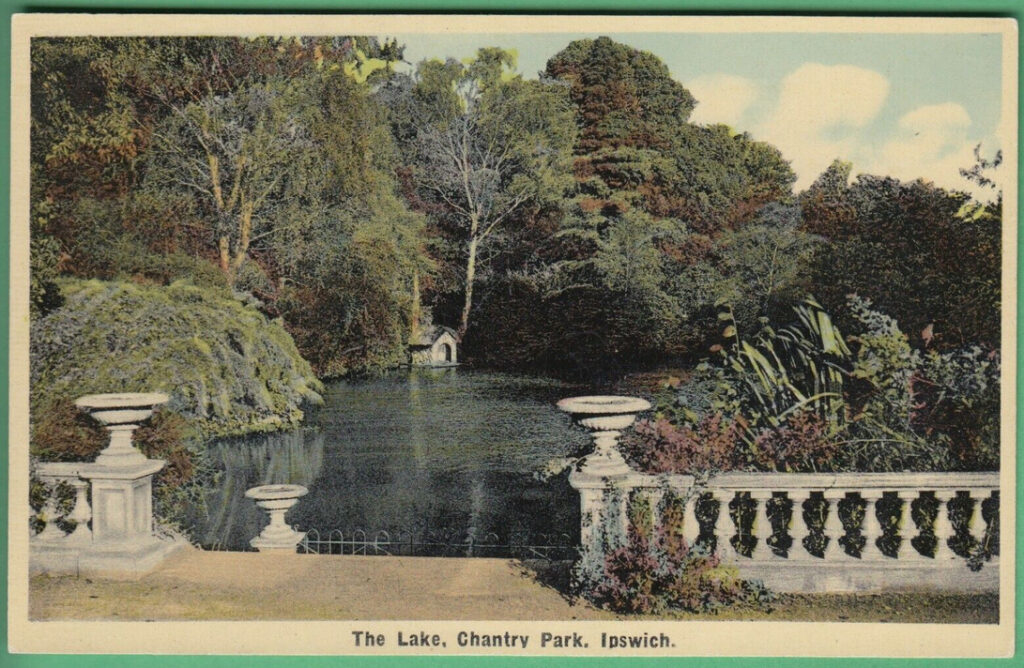
The long drive from the south-west gave dramatic views across parkland towards the house in the distance and continued to be used as an approach to The Chantry. It was described in 1829 as having a ‘handsome Lodge, of the Doric order, by Thompson, which is much and generally admired’, from which ‘the approach to the house through the premises extends about three-quarters of a mile by a large sheet of water, by groves, &c’, the remodelling of the existing body of water and woodland grove having been done by this time. The Doric-styled lodge at the entrance was demolished c. 1937. From this drive there were glimpses of the naturalistic Beech Water lying at the lowest point in the park. This had a densely-planted grove on its steep east bank made up of mixed planting, particularly beech, intersected by informal walks that survive as paths of worn earth. In a covert within the grove were an icehouse and the early-nineteenth century Laundry Cottages. The icehouse was covered with earth in the 1960s and only the foundations of the cottages remain. In the second half of the nineteenth century a boathouse was built on the banks of the lake that was demolished in the 1960s.
By the time of the map accompanying the 1837 tithe apportionment, the park that Charles Lillingston had bought a year earlier had contracted in size and was concentrated north of the house. Areas of parkland to the east, south and west were now named ‘Field’ on the tithe apportionment, possibly suggesting conversion to arable cultivation. At this time the area around Beech Water remained as a remote area of naturalistic pleasure grounds. The park’s northern boundary was now the Ipswich to Hadleigh road. The land to its north sloping down to the River Gipping was now owned by Robert Woodward rather than as part of the parkland shown on Hodskinson’s 1783 map. Charles is believed to have embarked on a programme of further landscaping, bringing many fields back into the park.
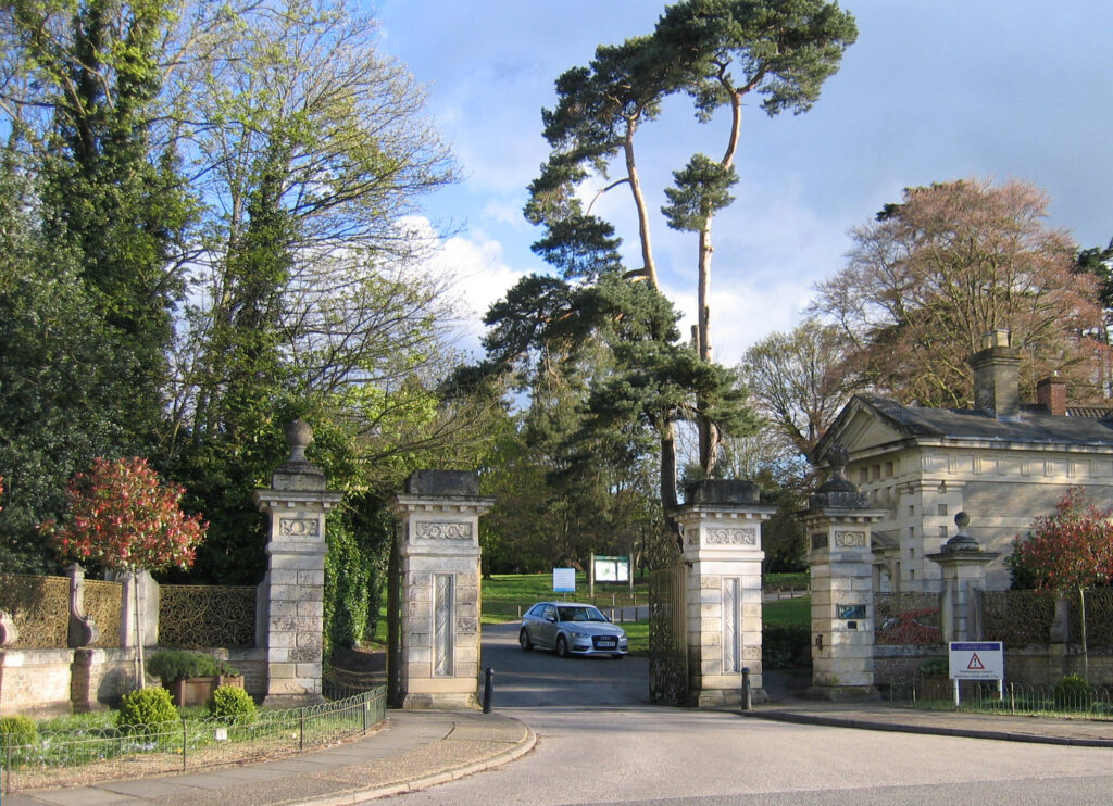
In addition to his Italianate remodelling of the house c. 1852, Sir Fitzroy Kelly altered the main approach to the house from the north by creating a single gently-curving drive starting about mid-point between the two earlier entrances. New entrance gate piers and gate house (Grade II) in the form of a classical temple were added. The main mid-nineteenth century wrought iron gates are set back from the road with a low curved brick wall topped with ornate wrought iron railings on either side. They were originally painted and gilded in blue and gold and known locally as the ‘Golden Gates’. Surviving specimen trees, possibly dating back to the eighteenth or early-nineteenth century, dot the lawns on either side of the north drive. The previous southernmost entrance along the Hadleigh Road was now only used for access to yards and the rear of the walled gardens, as it is today.
Chantry Park went into decline at the end of the nineteenth century until it was bought by Mrs Jump in 1906. She employed Roger Crompton Notcutt of Woodbridge, founder of today’s Notcutt’s nursery and garden centre, to replant parts of the estate and add some new features. After it was given to the people of Ipswich, the park saw the addition of sports facilities that now comprise tennis courts beside Lime Avenue, football pitches, a bowling green and cricket pitches near the south-west entrance. Avenue Lodge was built in the mid-twentieth century where Lime Avenue joins London Road.
The present park features a number of freestanding veteran trees including beech, oak, horse chestnut and sweet chestnut. A car park has been established close to the mansion and another by a children’s play area east of the mansion gardens. The western part of the park, including the grove and Beech Water, is designated a County Wildlife Site.
THE PLEASURE GARDENS
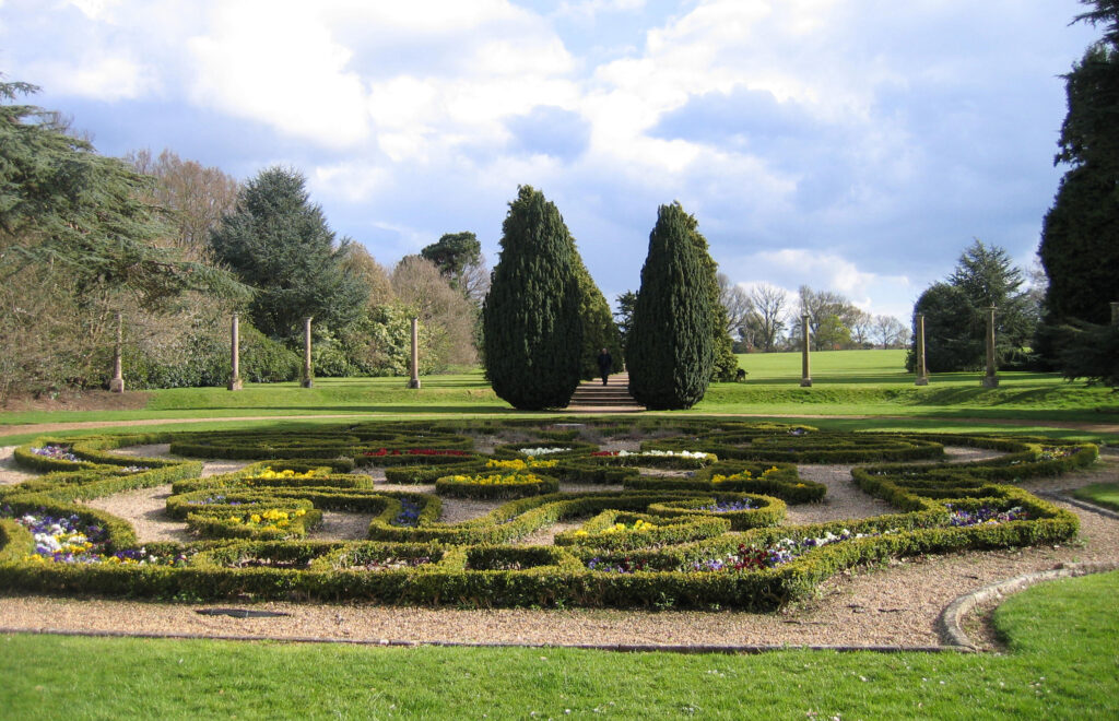
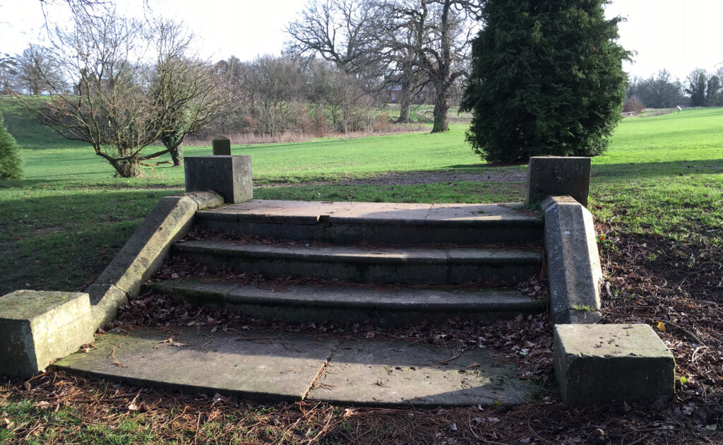
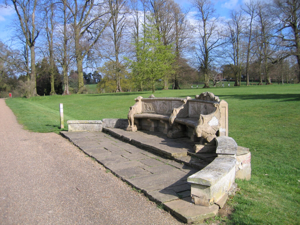
Little is known about the layout of the early pleasure gardens of The Chantry, although in 1829 they were described as having ‘rare and exotic plants’ with spacious lawns sloping down to the River Gipping. Sales particulars for the Chantry Estate dated 1867 suggest William Andrews Nesfield (1793–1881), the renowned landscape designer, had been employed by Sir Fitzroy Kelly to design the formal parterre and knot garden to the south of the mansion. This used intricate patterns of box tracery on gravel beds, decorated by urns and surrounded by a semi-circular grass terrace. A series of surviving columns, once topped with vases and linked together with chains, stand on this terrace. The main axis of this garden extends along a raised walk to a stone seat beside a grass bank that separates the pleasure gardens from the parkland to the south. As this bank does not appear on maps until 1887, it is probably not the work of Nesfield.
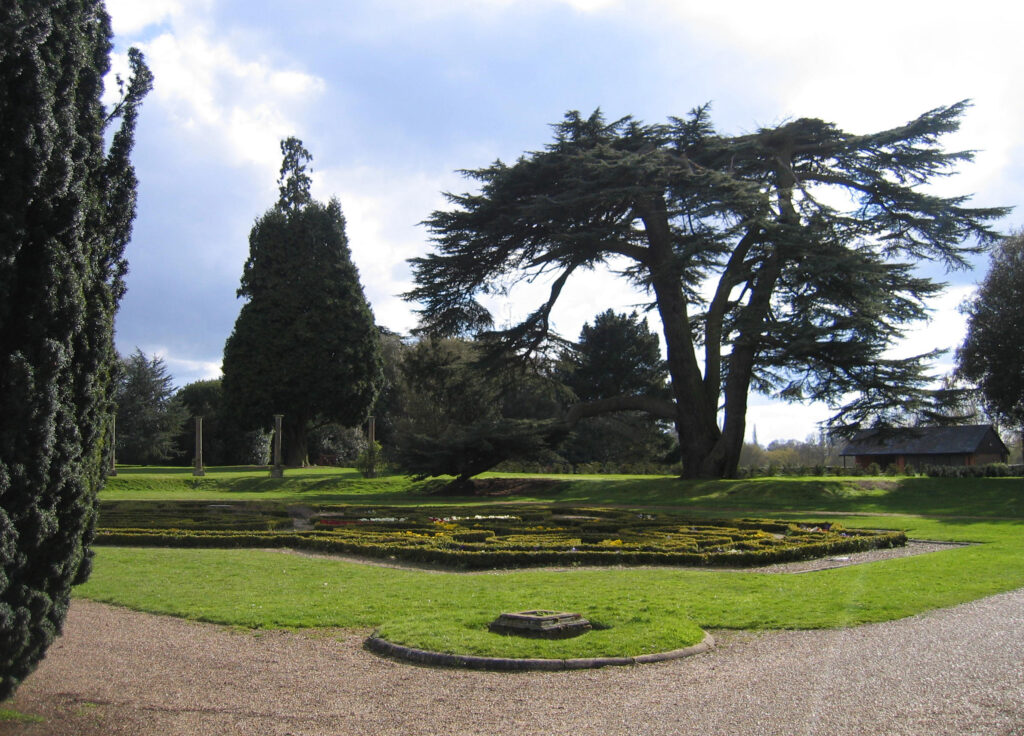
To the west of the parterre is a bowling green and beyond a small yew-hedged compartment divided into quarters by paths laid out by Mrs Jump and known as the English Garden. Further west is a woodland shrubbery with some majestic veteran trees including mature cedar of Lebanon with path leading through to a twentieth century rose garden and walled garden complex.
On the east front, lawns slope down to an ornamental L-shaped pond. A straight path, once leading from the now demolished conservatory, runs down to a small landing stage ornamented by surviving stone steps that once had balustrading, now gone. This pond is shown on the tithe map of 1837, but due to its shape, may be much older and possibly associated with Edmund Daundy’s chantry. It is now surrounded by mixed shrubberies, including many rhododendrons planted in the early-twentieth century by Mr Notcutt. The pond has a walkway along its eastern side, beyond which the ground slopes sharply down, suggestive of a made-made feature. A further walkway leading alongside the lawn to the east of the parterre is on its western side.
WALLED GARDEN COMPLEX
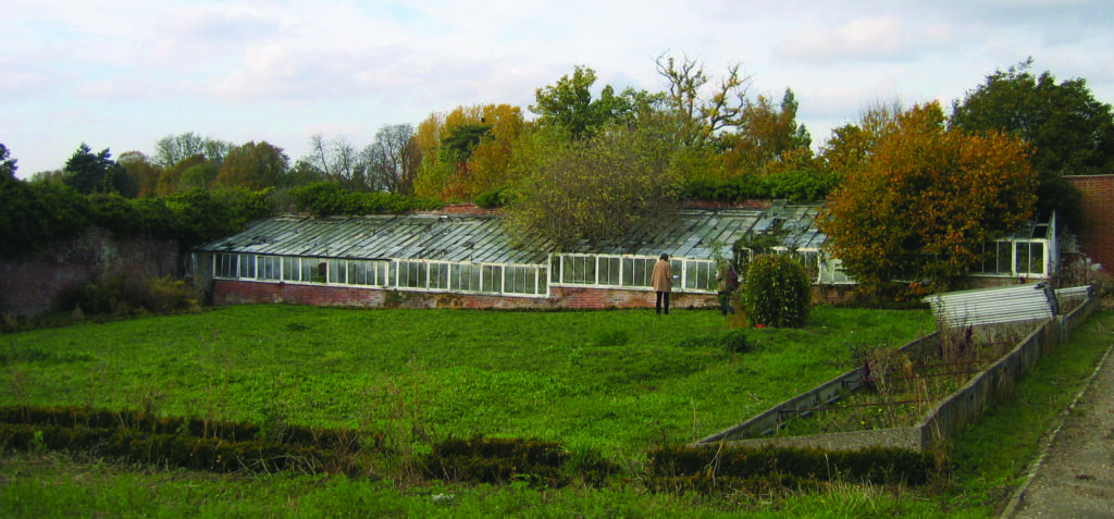
On sloping ground and lying c. 70m (230ft) west of the house is the walled garden complex, which sits in a lozenge-shaped area that includes the slip gardens outside of the walls. It consists of the main trapezoid-shaped walled garden covering an area of 80m (262ft) x 60m (197ft) with cut off south-east corner dating from the eighteenth century. Back sheds are attached to the outside of the north wall and a mid-nineteenth century gardener’s cottage with a mature espalier pear against its west wall. This large enclosure has a gothic-arched gateway along its southern wall giving access into the park and a bricked-up matching gateway on the western wall. At the time the mansion and park were given to the people of Ipswich in 1927 (see the 1927 OS map) it had perimeter and crosspaths, a freestanding glasshouse and stepped lean-to glasshouses against the south face of the north wall that survived in 2011 but have now gone. A large late-twentieth century glasshouse covers much of the internal space today.
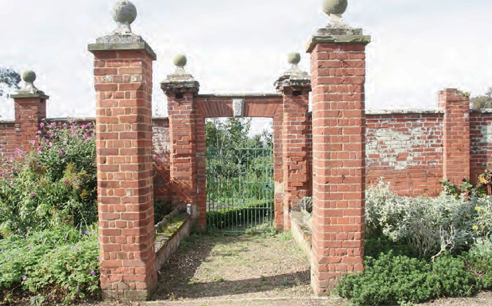
A smaller walled enclosure is attached to its east wall. Although shown on the tithe map as covering an area smaller than today, by 1886 it had been enlarged to the south so that its south wall joined the south-east corner of the larger enclosure to form a continuous southern wall along the edge of the adjoining parkland. Forming part of the major alterations and improvements made by Mrs Jump and Mr Notcutt, a newer section of wall was added that includes spaced piers topped by ball finials with an elaborate gated entrance with additional piers creating an open porch that has a date mark of 1908.
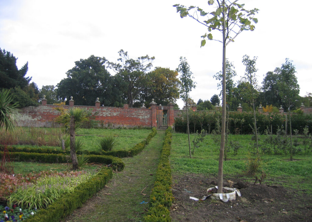
During the twentieth century Ipswich Borough Council first used the walled enclosures as a nursery ground. Later the larger garden enclosure became a centre for older people with learning difficulties and is today run by ActivLives, where the charity runs accessible activities and opportunities to learn new skills for members of the community, including plant rearing and an accessible dry garden for people with physical disabilities.
SOURCES:
Cromwell, Thomas, K., Excursions in the County of Suffolk, Vol. 1, 1818–1819.
Ipswich Borough Council, Chantry Park Conservation Area Appraisal and Management Plan, 1994 and in use 2019.
Jones and Co., Views of the Seats, Mansions, Castles, Etc. of Noblemen and Gentlemen in England, Wales, Scotland and Ireland, 1829.
Middleton-Stewart, Judith, ‘Change and Decay in East Suffolk: The Vicissitudes of Parish Fortunes’ in Suffolk Institute of Archaeology and History, Vol. XLI Part 3, 2007.
Neale, John, Preston, Views of the Seats of the Noblemen and Gentlemen in England, Wales, Scotland and Ireland, Vol. 6, 1823.
Pevsner, Nikolaus and Radcliffe, Enid, The Buildings of England: Suffolk, 1975.
Suffolk Gardens Trust, Walled Kitchen Gardens Recording Group, ‘Survey of Chantry Park Walled Gardens’, 2011 (unpublished document).
Williamson, Tom, Suffolk’s Gardens and Parks, 2000.
White, William, Directory of Suffolk, 1844, 1855, 1892.
https://landedfamilies.blogspot.com/2019/07/383-barker-of-grimston-hall-chantry.html (accessed April 2022)
https://activlives.org.uk/ (accessed September 2023)
1783 Hodskinson’s Map of Suffolk in 1783.
1847 tithe map and apportionment for Sproughton.
1886 (surveyed 1881) OS map.
1905 (revised 1902) OS map.
1927 (revised 1924) OS map.
2023 Google aerial map (Imagery © Bluesky, CNES / Airbus, Getmapping plc, Infoterra Lts & Bluesky, Maxar Technologies, Map data © 2023).
Heritage Assets:
Chantry Park (Grade II), Historic England Parks and Gardens Register No: 1000271. (https://historicengland.org.uk/listing/the-list/list-entry/1000271?section=official-list-entry)
The Chantry (Grade II), Historic England No: 1037783.
Gate House and North Entrance Gatepiers to Chantry Park (Grade II), Historic England No: 1236640.
Suffolk Record Office (now Suffolk Archives):
SRO (Ipswich) HD2833/1/SC379/5, Sales Particulars of the estate of The Chantry, 21 July 1927.
SRO (The Hold) HE402/1/1927/28, Sales Particulars for The Chantry, photographs, plan, newspaper cuttings and annotated ‘Re-sold to Sir Arthur Churchman’, 21 July 1927.
SRO (Ipswich) HD4052/171a/19, Newspaper article regarding gift of the park to the town of Ipswich, October 1930.
SRO (Ipswich) ID 406/9, Chantry Park Convalescent Home, 1995–1994.
Site ownership: Ipswich Borough Council
Study written: September 2023
Type of Study: Desktop and site visits 2011, 2016, 2020.
Written by: Tina Ranft
Amended:
