Parish: DENSTON
District Council: WEST SUFFOLK (previously St Edmundsbury)
TL 758 524
Not open to the public
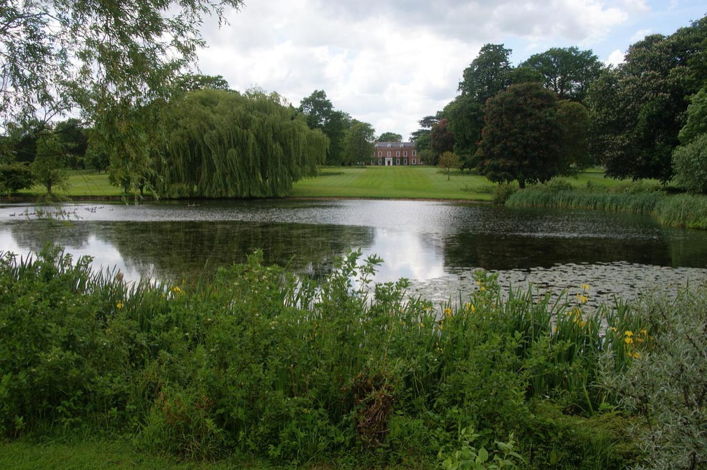
South of the village, Denston Hall (Grade II*) is c. 9.5km (6mls) north of Clare and c. 19km (12mls) south-east of Newmarket in an undulating arable landscape close to the River Glem, a tributary of the River Stour. In its own park, the Queen Anne house and its walled garden date to the early-eighteenth century, canals from that period and earlier, with a moat and rear wing of the house having a history going back to at least the sixteenth century.
OWNERS AND OCCUPIERS OF DENSTON HALL
Previously known as Denardiston, John Broughton acquired Denston manor through his marriage to Anne, the daughter of John Denston. After John Broughton’s death in 1479 it passed to his widow and then his brother, Sir Robert Broughton (d. 1506), who has been described as ‘one of the richest non-baronial landowners in England’, passing down through his family. During the sixteenth century it was the property of Henry Cheyney and William Burd, but it was seized by the crown for debt and leased to Sir John Robinson c. 1600. William Robinson went on to buy Denston in 1617 and it stayed in the Robinson family until the nineteenth century. It then passed to a distant relative, William Pigott Esq. of Dullingham House near Newmarket, whose son, Christopher Jeaffreson took the name Robinson in the mid-nineteenth century under an inheritance requirement. At this time the Hall was leased to Samuel Yate Benyon, whose widow continued to live at the property until at least 1874. The Denston Hall Estate was sold in 1896 and bought by Algernon Charles Wyndham Dunn-Gardner (1853–1929), the son of John Dunn-Gardner of Chatteris House in Cambridgeshire and Ada Pigott the daughter of William Pigott of Dullingham House. Algeron is recorded as living at Denston in 1913 and after his death it was inherited by his daughter Miriam, who became Mrs Leader with her marriage to Harvey Cliff Leader, a racehorse trainer at Newmarket. She made it her home until the late-twentieth century, since when it has changed owners more than once.
DENSTON HALL
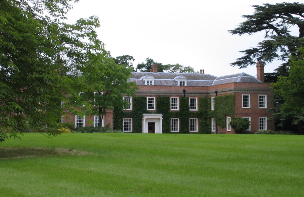
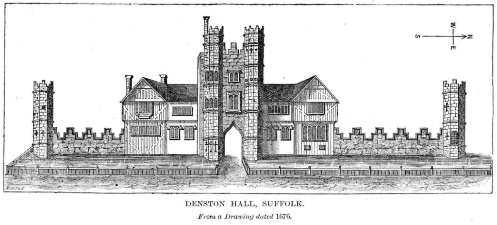
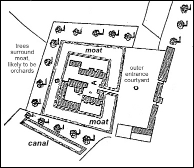
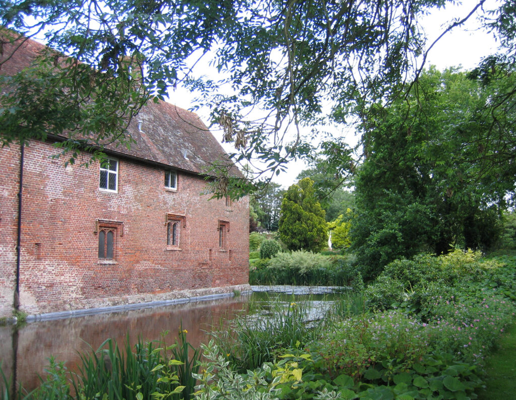
Denston Hall is an early-eighteenth century, or possibly late-seventeenth century, house probably built by Sir John Robinson (c. 1655–1704) after he inherited the Tudor mansion on the site from his grandfather. The remains of that earlier manor house form the existing long range to the rear of the present Hall. It has been suggested that this range was part of a chantry or college founded in the reign of Edward VI. Listed by Historic England as early-sixteenth century, the red brick rear range is said by Anthony Emery, the architectural historian and writer, to have been built slightly earlier by Sir John Denston in c. 1475. The house of this date he describes as a courtyard mansion that had a ‘balanced display frontage, with moat, a commanding central gatehouse, embattled ranges round all sides, and corner turrets’.
The front of the early-eighteenth century house is red brick and two storeys high with attics. Later works of c. 1770 are to left and right of the circular entrance hall. In 1855 it was described as ‘a large neat mansion in a small park’. To the north-west of the Hall is a mid- to late-sixteenth century barn (Grade II) with an attached small timber dovecote, lying beside an irregularly-shaped pond.
DENSTON PARK
Not known to have been the site of a medieval deer park, by the late-eighteenth century Hodskinson’s 1783 map shows a roughly rectangular park to the east of Denston Hall, its northern boundary formed mainly by the River Glem with the main entrance drive from the village as its western boundary.
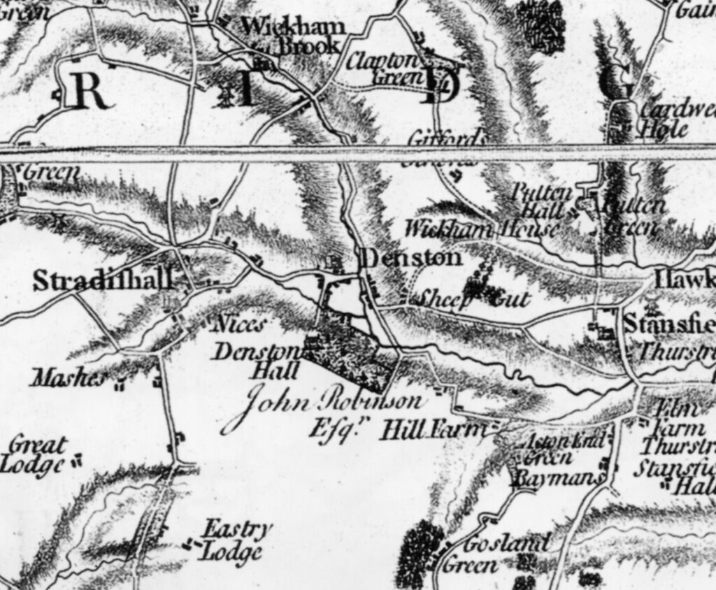
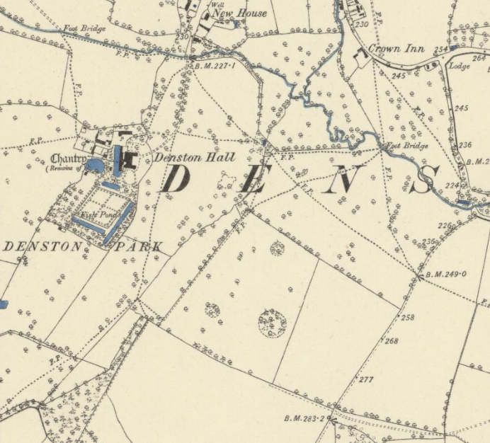
At the end of the nineteenth century an irregularly-shaped park surrounded the house, said to be nearly c. 40.5ha (100a) at the time of the sale in 1896, its shape suggesting it expanded in all directions by the enclosure of arable fields over the previous centuries. Although if Hodskinson’s 1783 map is accurate the park mainly expanded to the west and south over the following century. The 1885 OS map shows a park dotted with freestanding trees, many surviving today, with a few clumps of trees and shelterbelts to the south and west, possibly planted when the park was expanded in the late-eighteenth and early-nineteenth centuries. These have been expanded over recent years. Although criss-crossed with footpaths and tracks, since the nineteenth century there appears to have been only one entrance into the park. This follows a route south from the village crossing a bridge over the River Glem towards the Hall. A seventeenth century timber-framed cottage (Grade II) stands just outside the park at the entrance that, although not marked as such on any OS maps, possibly served as a lodge. Nearby, a photograph in the Spanton Jarman Collection taken around the turn of the twentieth century shows a simple set of gates at this entrance, although these were replaced by the much grander, tall gate-piers and ornate iron gates seen today. A building marked ‘Lodge’ is shown on both the 1885 and 1905 OS maps in the north-east corner of the park, although there are no obvious tracks or even footpaths entering the park at this point. There appears to be no obvious reason for a lodge in this position. This may have been a cartographic error or an earlier lodge that marked the entrance to the park where a long-gone drive had once been.
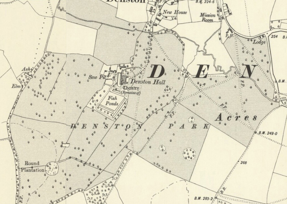
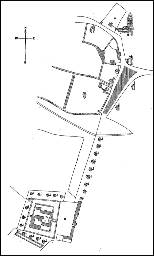
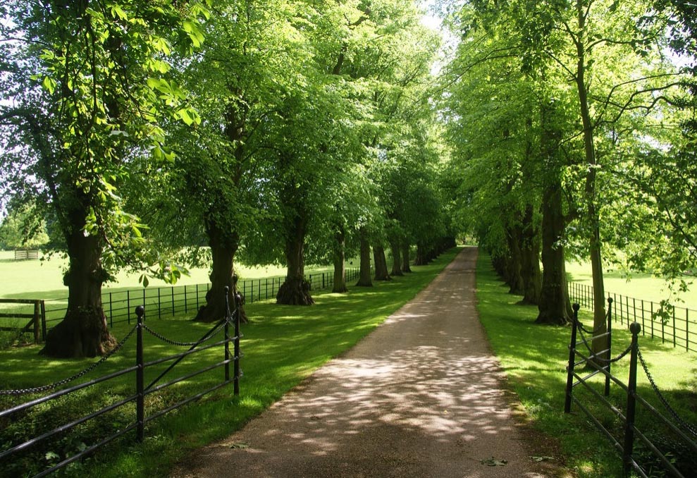
A map of the site in 1676 redrawn by F. Hazelwood in 1888 shows a line of trees along the entrance drive that arrived at the outer entrance courtyard to the east of the moated house, from where access is by a bridge across the eastern arm of the moat, through a gatehouse and into the inner courtyard of the Hall. The buildings that formed the east and south sides of this outer courtyard had gone by the time of an estate map dated 1778 allowing an open view across the parkland for the new house. Today an avenue of mature lime trees lines this drive. These are unlikely to date back to the seventeenth century and are probably a replanting during the nineteenth century.
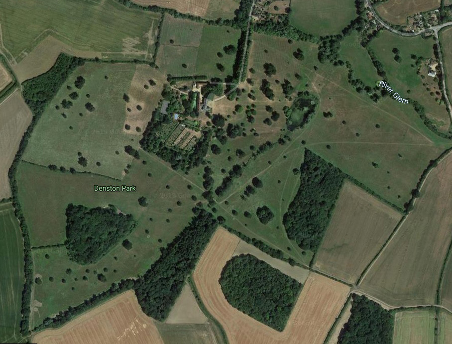
Little has changed in the park since the late-nineteenth century. A few fields at the eastern margins have been turned over to arable and two small, circular woods to the east and south of the Hall have expanded in size with new plantings. A major addition is a new lake centred on the central axis of the east front of the house, created in the early-twenty-first century.
THE GARDENS
The redrawing of a 1676 map shows a square moat around Denston Hall, the eastern arm bridged giving access from the outside entrance courtyard. Surrounding the moat on three sides are trees, probably orchards, and beyond the southern arm of the moat is an ornamental canal or perhaps a fishpond. The four sides of the moat survived until 1778, although it has been suggested that it was mostly infilled soon after, leaving just the surviving west arm water-filled.
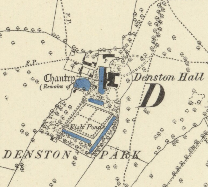
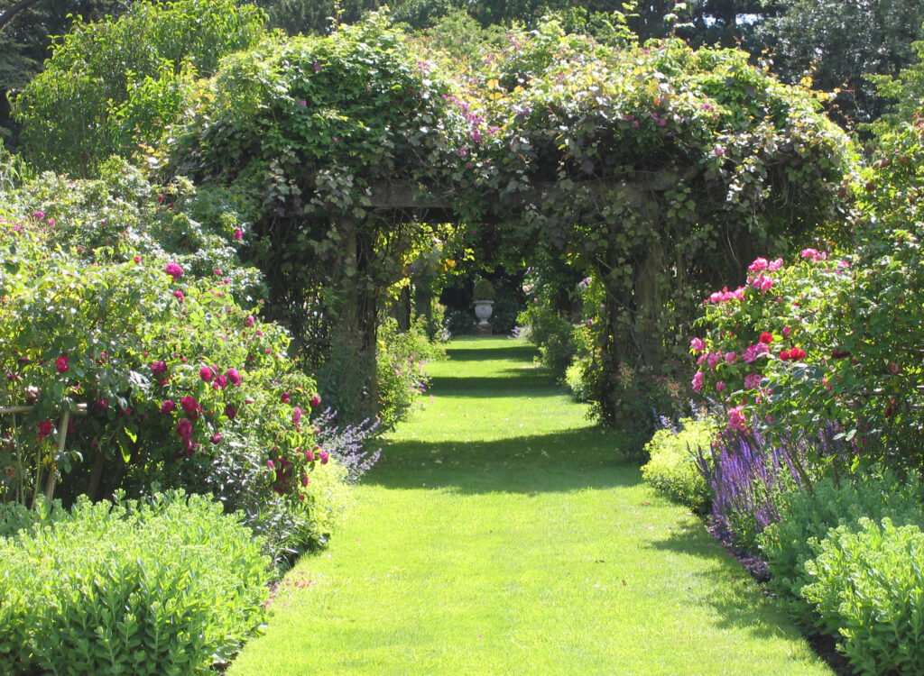
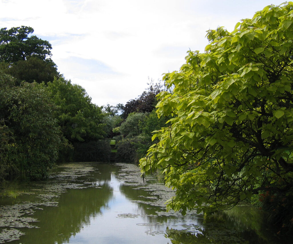
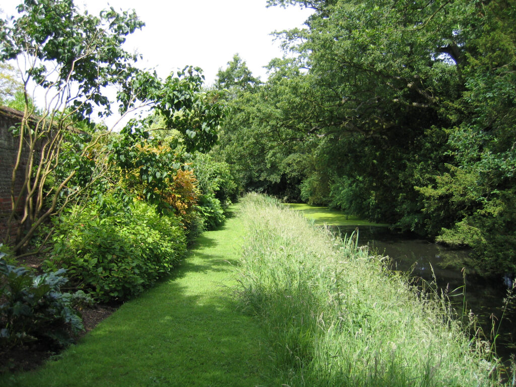
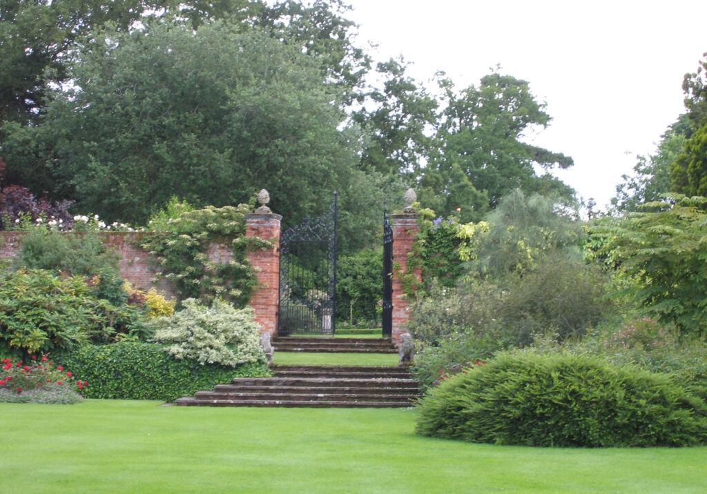
A lozenge-shaped walled garden stands south of the house. This was shown on the 1778 map and may be the work of Col. John Robinson (c. 1679–1734) in the early-eighteenth century. Some of the surviving high red-brick walls date back to this period and have much ornamentation. Internally, perimeter and cross paths are shown on the 1778 map, as are two buildings in the north-west corner. Believed to be contemporary with the walled garden are three garden canals, in part likely to have developed from earlier fishponds. The longest is the east canal at 110m (360ft) by 8m (26ft) wide. The southern canal is 8m (26ft) wide by 78m (255ft) long and is shown on the 1778 map aligned on a small square structure 30m (98ft) from its western end. This was possibly an additional ornamental dovecote to add to the other attached to the sixteenth century barn west of the house. The northern canal is c. 40m (131ft) long and 10m (32ft) wide and is a shortened version of the canal or fishpond shown on the 1676 map, allowing the creation of an area of garden with paths leading through trees and shrubs connecting the walled garden and surrounding slip gardens to the south wing of the new house.
Having changed little since the 1885 OS map, the walled garden and canals lie within a rectangular enclosure, including an orchard to the west. A mature tree-lined walk runs parallel and outside of the east and south canals, returning towards the house beside the west wall.
In the early part of the twenty-first century the walled garden was mainly given over to decorative planting, with grass paths leading through rose arches and herbaceous planting. About a third was for fruit, vegetables and a cutting garden. Outside the canals are lined with grass paths bordered by beds containing various shrubs. Lawns, shrubs and flower borders adorn the rest of the pleasure gardens. In about 2017, after a change of ownership of the estate, garden designers Mark Rumary and Xa Tollemache redesigned many elements of the garden.
SOURCES:
Barker, H. R., West Suffolk Illustrated, 1907.
Copinger, W. A., The Manors of Suffolk, Vol. 5, 1909.
Emery, Anthony, Greater Medieval Houses of England and Wales, 1300–1500: Volume 2, 2000.
Hazelwood, F., ‘Parish Records of Denston’ in Suffolk Institute of Archaeology and History Proceedings, Vol. V1, Part 3, 1888.
Kirby, John, The Suffolk Traveller, 1764.
Martin, Edward, ‘Garden Canals in Suffolk’ in East Anglia’s History: Studies in Honour of Norman Scarfe, 2002.
Martin, Edward, ‘Excursion to Denston Hall, 24 July 1994’ in Suffolk Institute of Archaeology and History Proceedings, Vol. XXXVIII, Part 3, Excursions, 1995.
Ross, James, John de Vere, Thirteenth Earl of Oxford (1442–1513); ‘The Foremost Man of the Kingdom’, 2011.
The Mark Lane Express, Agricultural Journal, vol. 74, 1896.
Walford’s County Families of the United Kingdom, 1913.
White, William, History, Gazetteer, and Directory of Suffolk, 1844 and 1855.
https://houseandheritage.org/2018/06/14/dullingham-house/ (accessed April 2019).
https://en.wikipedia.org/wiki/John_Dunn_Gardner (accessed April 2019).
Hodskinson’s Map of Suffolk in 1783.
1885 (surveyed 1884) Ordnance Survey map.
1905 (revised 1902) OS map.
1951 (revised 1949) OS map.
2022 Google aerial map (Imagery © Bluesky, CNES / Airbus, Getmapping plc, Infoterra Lts & Bluesky, Maxar Technologies, Map data © 2022).
Suffolk Record Office (now Suffolk Archives):
SRO (Bury) 279/6. Thomas Warren’s map of Denston Hall.
Heritage Assets:
Suffolk Historic Environment Record (SHER): DNT 003, DNT 005, DNT 010, DNT 011.
Barn to the North West of Denston Hall (Grade II) Historic England No: 1264717.
Denston Hall (Grade II*), Historic England No: 1031702.
Park Gates to Denston Hall (Grade II), Historic England No: 1031664.
Historic England Research Records Hob Uid: 545952.
Historic England Research Records Hob Uid: 379570.
Site ownership: Private
Study written: January 2023
Type of Study: Visit 2007/Desktop
Written by: Tina Ranft
Amended:
