Parish: GIPPING PARISH
District Council: MID SUFFOLK
TM 073 635
Not open to the public
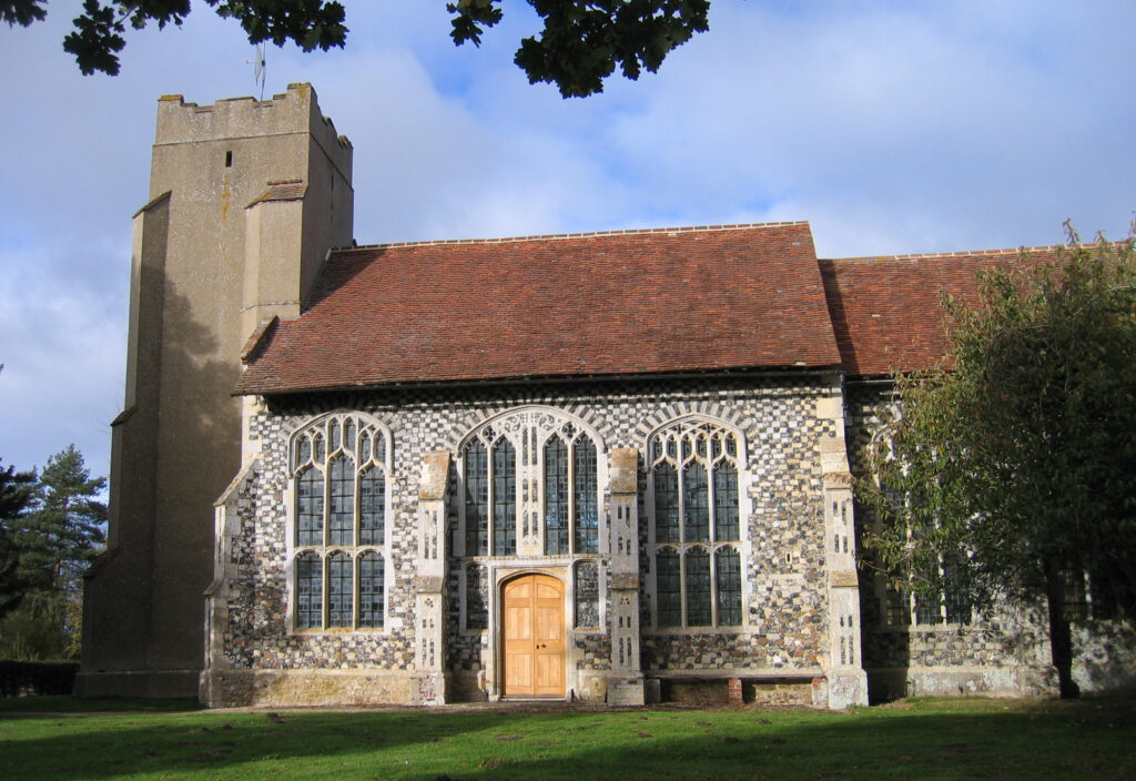
The site of Gipping Hall, demolished c. 1860, is c. 6.5km (4mls) north-east of Stowmarket on the Suffolk clayland plateau above a tributary valley of the River Gipping, with views of the ancient woodland of Gipping Great Wood to the south. It was next to the Chapel of St Nicholas (Grade I) and opposite Chapel Farmhouse (Grade II), at the end of a long, narrow green running northward from Gate Farmhouse (Grade II) at the junction with the winding road between Mendlesham Green and Old Newton. The Gipping Hall Estate was owned by the Tyrell family until it’s demolition and the chapel believed to have been in existence in 1340. It was probably rebuilt c. 1483 as a private chapel by Sir James Tyrell, who was suspected of being involved in the murder of the princes in the Tower of London but escaped execution and retreated to Gipping Hall.
The rich and powerful Tyrell family were resident at the Hall until the end of the eighteenth century, the last being the Revd Charles Tyrell (1776–1811), vicar of Thurston and rector of Thornham Magna and Thornham Parva who inherited the Gipping estate from his cousin Edmund Tyrell in 1799. By the time his son Charles (1776–1872) took over the Hall in 1811 it was let to Sir John Shelley and Charles lived at Plashwood near Haughley, later moving to Polstead Hall. In 1844, when the Hall was let to R. Dalton, it was described as ‘a large ancient brick mansion in a park of 60 acres [24ha]’, the park being much diminished from its former size. By 1855 the house was unoccupied and demolition soon followed.
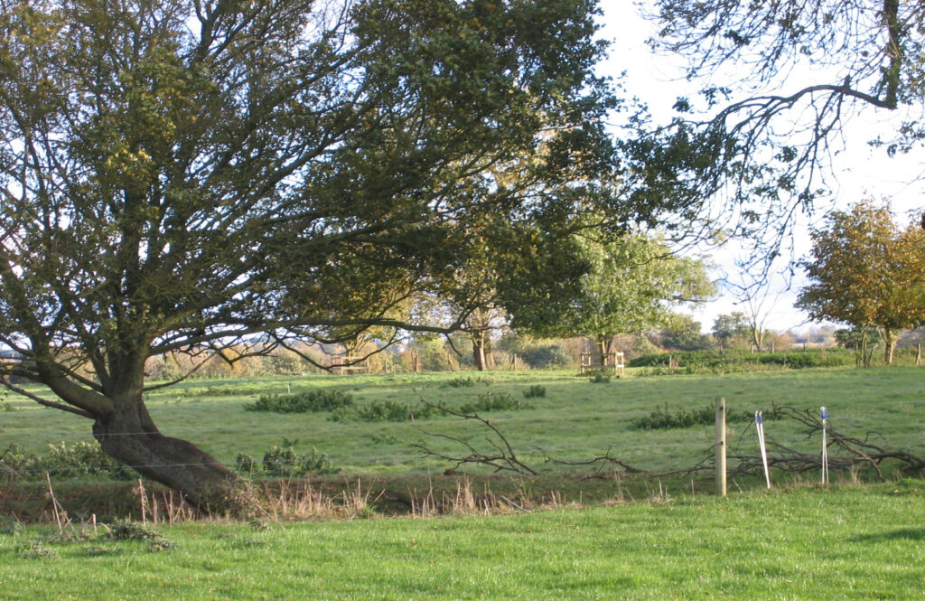
Although eighteenth century maps mark the house and chapel but not an attached park, in its heyday during the fifteenth to seventeenth centuries and given its high-status, Gipping Hall mansion is likely to have been set in a much larger park than shown on the 1846 tithe map when the house was tenanted. For many centuries the green would have acted as a wide formal entrance drive culminating in a view of the elaborate chapel at its northern end. Although the public highway now stops at this point, a track with public access continues northward towards Cotton. Opposite the chapel is Chapel Farm, the once home farm for Gipping Hall and hidden from view by modern farm buildings further west lies an early-eighteenth century octagonal dovecote (Grade II).
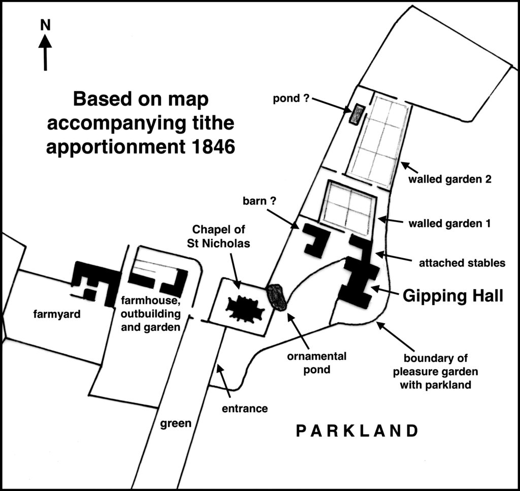
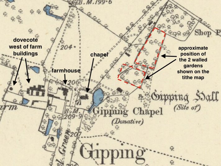
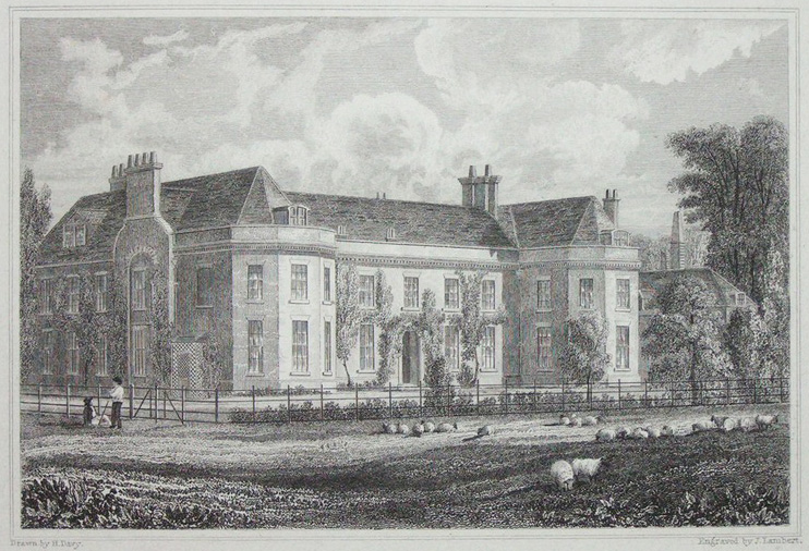
Davy’s 1824 engraving of Gipping Hall shows a wrought iron fence close to the large H-shaped house separating it from parkland where sheep graze. A newly-planted hedge and young trees are depicted along the eastern boundary between the gardens and park that would have obscured views over parkland in that direction but helped to deal with the cold east winds buffeting Gipping Hall. The top of a clock tower on a stable building and mature ornamental trees are shown behind the house. By the time of the map accompanying the 1846 tithe apportionment there was a large building, possibly a barn of a much earlier date, north-west of the mansion and an L-shaped ornamental pond over which there would have been views to the chapel. It has been suggested that Gipping Hall was a base for hunting, which may explain why there is so little area given over to a formal garden. The site also included two walled enclosures to the north that are shown with perimeter and cross paths typical of kitchen gardens. The garden nearest the house was a parallelogram shape, which would have given more area of sheltered walling than the rectangular-shaped further garden. Once the house was demolished the walls of these gardens slowly deteriorated and scattered trees took over the site, although some walls appear to have survived into the 1900s. This area is now agricultural grazing land with only humps, bumps and clumps of nettles, shrubs and trees acting as the ghost of their former existence.
SOURCES:
Birch, Mel, Suffolk’s Ancient Sites Historic Places, 2004.
Davy, H, Views of the Seats of the Noblemen and Gentlemen in Suffolk, 1826.
Fisher, D. R. (ed), The History of Parliament: the House of Commons 1820–1832, 2009.
McCann, J., The Dovecotes of Suffolk, 1998.
Pevsner, N, & Radcliffe, E. The Buildings of England: Suffolk, 1974 edition.
White, William, Directory of Suffolk, 1844, 1855.
Kirby’s 1736 map of Suffolk.
Hodskinson’s Map of Suffolk in 1783.
1846 (surveyed unknown date) tithe map and apportionment.
1885 (surveyed 1884) Ordnance Survey map.
1905 (revised 1903) OS map.
2022 Google aerial map (Imagery © Bluesky, CNES / Airbus, Getmapping plc, Infoterra Lts & Bluesky, Maxar Technologies, Map data © 2022).
Heritage Assets:
Suffolk Historic Environment Record (SHER): GPP 001, GPP 003, GPP 005, GPP 006.
Chapel of St Nicholas (Grade I), Historic England No. 1352278.
Chapel Farmhouse (Grade II), Historic England No. 1285268.
Gate Farmhouse (Grade II), Historic England No. 1032729.
Dovecote 130 metres west of Chapel Farmhouse (Grade II), Historic England No. 1032728.
Site of Gipping Hall, Historic England Research Record, Hob Uid: 387026.
Site ownership: Private
Study written: January 2023
Type of Study: Desktop
Written by: Tina Ranft
Amended:
