(Hall demolished c. 1785)
Parish: KEDINGTON
District Council: WEST SUFFOLK (previously St Edmundsbury)
TL 705 471
Not open to the public
The site of the former moated Kedington Hall is immediately north of the fifteenth century Church of St Peter and Paul (Grade I) in the village of Kedington (also known as Ketton) c. 4.8 km (3mls) north-east of Haverhill. Both church and Hall are on the east bank of the River Stour, which forms the boundary between Suffolk and Essex and in what was originally an isolated position outside and north of the village.
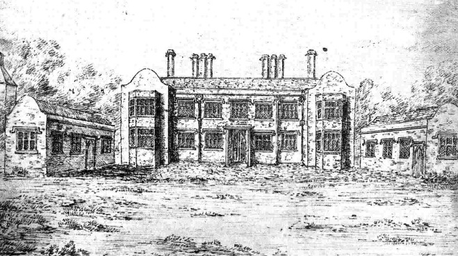
The original Kedington Hall was the manor house of the Kedington (Kedyngton) family, but in the early-fourteenth century it became the property of the ancient and important Barnardiston family, whose ancestral home was in the neighbouring Barnardiston parish. It seems likely it was Sir Thomas Barnardiston (c. 1440–1503) who rebuilt the manor house on the site. In 1578 they played host to Queen Elizabeth I at Kedington on her procession through Suffolk and about forty years later the Hall was remodelled to form a classic Jacobean house, probably by Nathaniel Barnardiston (c. 1588–1653). The family were prominent Puritons and became leaders of the Parliamentarians in Suffolk during the English Civil War in the middle of the seventeenth century. The family held Kedington until the mid-eighteenth century, but after the direct family line died out the estate was sold and the house was demolished in c. 1785. A drawing of the Hall just before it was pulled down made in the 1820s, possibly from memory or from earlier representations, depicts a classic Jacobean mansion.
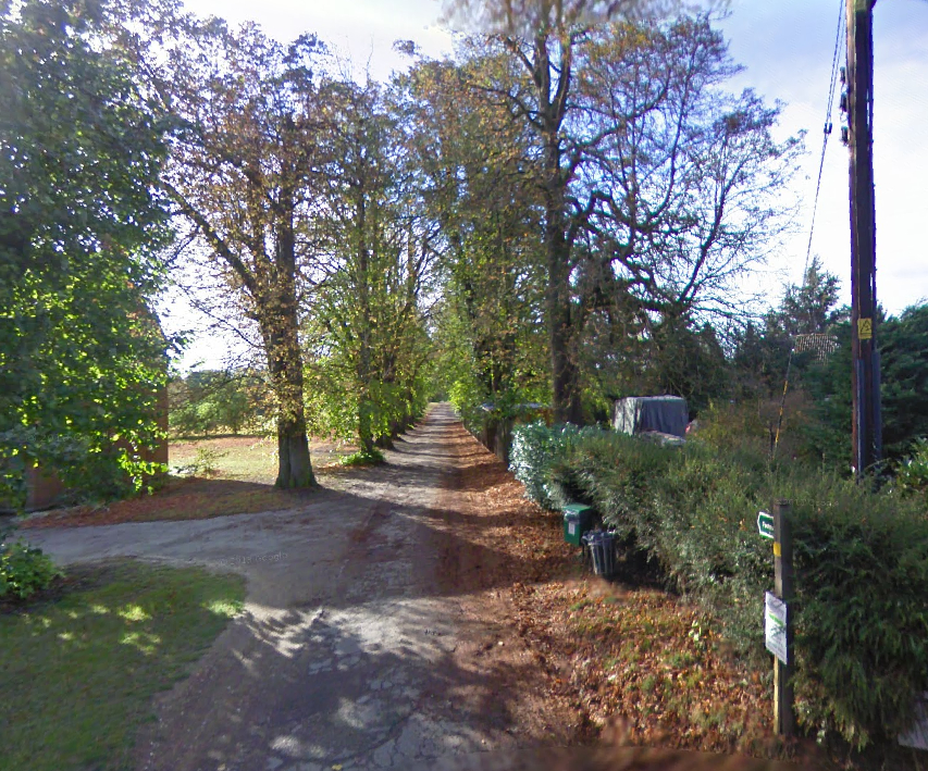
The mound on which the Hall stood and a dry moat, part of which is shown on the 1885 OS map, survived into the 1990s but have since been filled and levelled to become part of an arable field, although today the shape of the northern and eastern arms of the moat can faintly be seen on LiDAR imagery and, with the right soil conditions, as cropmarks on aerial photographs. The 1841 tithe map shows an avenue from the south leading to the east side of the church, and shown on the later 1885 map continuing northward beside a square enclosure, named ‘Hall Garden’ on the tithe map, to arrive at the south-east corner of the moat.
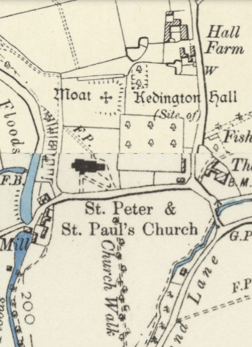
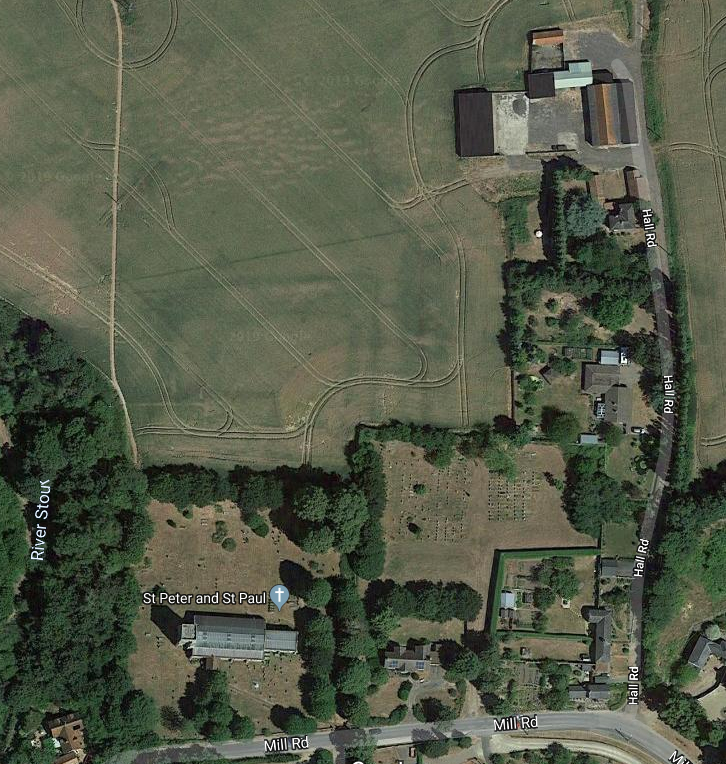
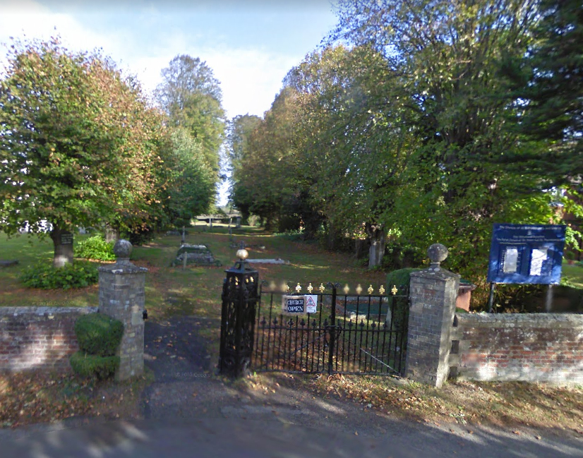
Today the route of the avenue survives as a public footpath lined with more recently planted trees to the south of the site. At its northern end the route continues through the churchyard east of the church, also replanted. Surviving c. 3m (10ft) high red brick walls mark a square garden enclosure that would have been attached to the south-east corner of the moat. This was the kitchen garden for the house. Centrally along its southern side is an entrance gateway of unknown date with high pillars, which is marked by a single line from the road on the 1885 map. Today the inside of the enclosure is taken up with a graveyard extension and private gardens. One house has been built against the south wall and another converted from outside sheds attached to the southern end of the east wall that can be seen on the map.

SOURCES:
Birch, Mel, Suffolk’s Ancient Sites Historic Places, 2004.
Burke, John, A genealogical and heraldic history of the extinct and dormant baronetcies of England, Ireland and Scotland, 1841.
Hazelwood, F., ‘The ancient families of Suffolk (from the notes of Sir Richard Gipps’ in Suffolk Institute of Archaeology and History, Proceedings Vol. VIII, Part 2, 1893.
Landed Families of Britain and Ireland, https://landedfamilies.blogspot.com/2019/10/395-barnardiston-of-kedington-hall.html (accessed January 2023)
Suffolk Institute of Archaeology and History, Proceedings Vol. XXXVIII Part 2, 1994, Excursions 1995.
Once the moated site of an ancient manor house owned by the Barnardiston family who entertained Elizabeth I in 1578, Kedington Hall stood next to the parish church and was remodelled in the early-seventeenth century but demolished c. 1785. Its dry moat survived into the late-twentieth century but was filled to become part of an arable field. The walls of its kitchen garden mostly survive, although it is now the site of a churchyard extension and two residential gardens. The route of an ancient entrance avenue leading to the Hall from the village survives, although replanted, and is now part of the Stour Valley Path.
Not open to the public http://www.stedmundsburychronicle.co.uk/Chronicle/Havto1899.htm (accessed October 2019).
Hodskinson’s Map of Suffolk in 1783.
1841 tithe map and apportionment.
1885 (surveyed 1885) Ordnance Survey map.
National Library of Scotland Side by Side maps 1888–1913 OS map and LiDAR image at https://maps.nls.uk/geo/explore/side-by-side/#zoom=16.0&lat=52.09718&lon=0.48788&layers=6&right=LIDAR_DTM_1m (accessed February 2019)
2022 Google aerial map (Imagery © Bluesky, CNES / Airbus, Getmapping plc, Infoterra Lts & Bluesky, Maxar Technologies, Map data © 2022).
Heritage Assets:
Suffolk Historic Environment Record (SHER): KDG 001.
Church of St Peter and St Paul (Grade II), Historic England No: 1376724.
Site ownership: Private
Study written: January 2023
Type of Study: Desktop
Written by: Tina Ranft
Amended:
