Parish: TOSTOCK
District Council: MID SUFFOLK
TL 953 632
Not open to the public
Tostock village is c. 11km (7mls) east of Bury St Edmunds, with Tostock House (Grade II) lying to the south-west of the main village settlement. The village stands at c. 65m (213ft) above sea level and is on the edge of the Suffolk clayland plateau. The garden of Tostock House was once beside the main A14 turnpike road between Ipswich and Bury St Edmunds, although the road was moved slightly further south in the last few decades when it was upgraded.
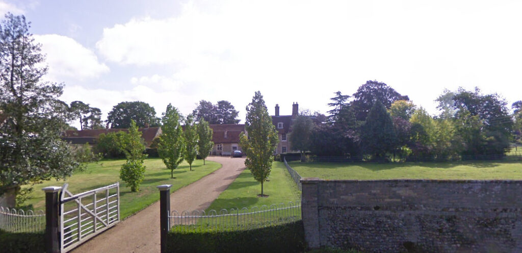
With an earlier timber-framed core and early-seventeenth century axial red brick chimney, the present house was substantially renovated and extended in the early-nineteenth century when it is said to have been a farmhouse. It is two storeys high plus attic and built of flint rubble with gault brick dressings. Its entrance front faces west. Also on the site are a group of early-nineteenth century buildings, often referred to as ‘offices’, consisting a coach house, stables and lodgings (Grade II) plus a large eleven-bay barn (Grade II) of a similar age, also of flint rubble and brick. These impressive buildings suggest a farmhouse of some status and are arranged beside Tostock Leys, a green that was once used for grazing. It was crossed by tracks and one leading to the village centre became the road known today as Leys Road.
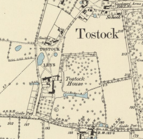
In 1851 Tostock House was the home of Revd William Gilbert Tuck (b. 1810 in Norfolk), at the time curate of Tostock but later becoming rector, whilst the family of the late Revd James Oates stayed in Tostock Rectory after his death. The tithe map of 1843 shows Tostock House surrounded by agricultural fields with an orchard to the south.
By 1884 William had converted some surrounding fields into a small park with a shelterbelt of trees to the north giving privacy from the green and agricultural fields. Isolated trees were dotted across the whole area of parkland and an existing natural linear pond was converted to an ornamental feature with a small island at its west end that could be viewed across a lawn from the rear of the house.
At this time the L-shaped house still had little in the way of gardens with the orchard remaining to the south. In 1887 William died, but as with the Oates family at the rectory, William’s widow and family continued to live at Tostock House until it reverted back to a farmhouse in the early-twentieth century. By the time of the 1905 OS map the orchard south of the house had become an area of lawn with a few trees, possibly surviving fruit trees, which had been incorporated into the gardens.
Few changes took place to the layout of the grounds of Tostock House over the next fifty years, however the field outside the park boundary to the north had become a commercial orchard. A boat house at the eastern end of the linear pond that was shown on the 1905 OS map was still named on the 1953 OS map, although it is unknown if this survives.
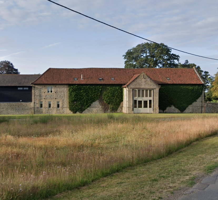
During the second half of the twentieth century the west wing of the house was demolished and Tostock House had ceased to be a farmhouse. Today a substantial new house has been built in the northern portion of the original parkland with the subsequent loss of grounds for Tostock House. The pond survives, albeit obscured by trees. Most of the original farm buildings, and possibly the impressive barn, have become residential properties.
SOURCES:
Birch, Mel, Suffolk’s Ancient Sites Historic Places, 2004.
Copinger, W. A., The Manors of Suffolk, Vol. 6, 1910.
Mid Suffolk District Council, Tostock Conservation Area Appraisal, 2006.
Walford, Edward, Walford’s County Families of the United Kingdom, 1912.
White, William, Directory of Suffolk, 1874.
Who’s Who, Vol. 58, 1906.
https://tostock-pc.gov.uk/past-and-present/digital-archive/chapter-2-farming-in-tostock/ (accessed June 2025).
Census: 1851, 1861, 1881, 1891, 1901, 1911.
1843 (surveyed 1843) tithe map and apportionment.
1884 (surveyed 1883) Ordnance Survey map.
1905 (revised 1903) OS map.
1953 (revised 1950) OS map.
Heritage Assets:
Suffolk HER: TCK 018, 020.
Tostock House (Grade II). Historic England No. 1032398.
Coach House, Stable and Lodgings North of Tostock House (Grade II), Historic England: No. 1352418.
Suffolk Record Office (now Suffolk Archives):
HE402/2/1924/4, Sales Particulars Tostock House, 16 September 1924.
Site ownership: Private
Study written: July 2025
Type of Study: Desktop
Written by: Tina Ranft
Amended:
