(previously St Paul’s Home, later The Oaks and Corners House)
Parish: WOOLVERSTONE
District Council: BABERGH
TM 182 387
Not open to the public
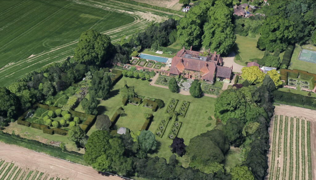
On the Shotley Peninsular, c. 6.5km (4mls) south of Ipswich, Woolverstone House (Grade II*) was completed in 1901 to designs by Sir Edwin Lutyens, known for his Arts and Crafts creations, who worked with Gertrude Jekyll on a number of gardens. Gertrude has been suggested as the designer for the gardens at Woolverstone, although it seems more likely it was her style that was the inspiration for Lutyens’ garden designs here.
Originally called St Paul’s Home, later Corners House, it was built for Mary Berners, the wife of Charles Hugh Berners who owned Woolverstone Park and donated the land, which lay on the western edge of his parkland. The house was used as a rest home for the St Peters order of nuns and a home for orphan girls. At the outbreak of World War I it was donated by Charles Hugh Berners as a Red Cross convalescent hospital for wounded soldiers. Afterwards it became a private residence in the ownership of Oxford University. During the 1960s and 1970s it was a school and returned as a private residence in the 1980s.
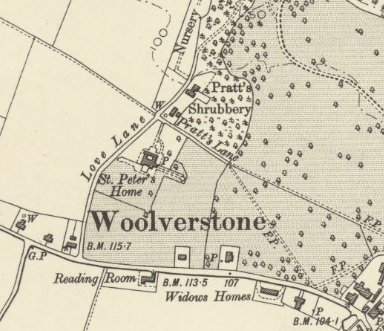
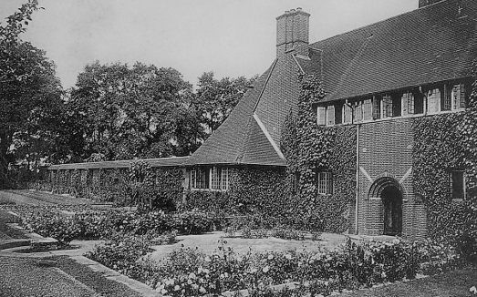
Within Woolverstone Conservation Area, the house is accessed from Mannings Lane, which leads down to the Orwell estuary to the north. The driveway, now lined with mature lime trees, gives access to the north-facing entrance front. Of a relatively small size, the red brick house was built on a courtyard plan with a centrally-placed, single-storey entrance range to the north and attached chapel to the left (east). Buttressed and with tile copings, three metre high garden walls with round arched gateways are attached to each side of the house and are included in the house listing. To the rear (south) of the house is a sunken garden (Grade II), also designed by Lutyens. It includes a paved area and brick retaining walls with stone copings. Steps with tile risers are circular in plan and built around an inset millstone. The gardens of c. 1.7ha (4.24a) are divided into a number of separate compartments or rooms and include lawns, formal hedges, herbaceous beds and trees such as oak, lime, magnolia and cherry, all surrounded by mature high hedges, mainly of holly. More recent additions include a swimming pool garden, tennis court and football pitch.
SOURCES:
Babergh District Council, Woolverstone Conservation Area Appraisal, 2008.
Sandon, Eric, Suffolk Houses, A Study of Domestic Architecture, 1977.
Sales Particulars, Strutt & Parker and Knight Frank, 2013.
https://greatwarhomehospitals.wordpress.com/home/ipswich-woolverstone-red-cross-hospital/ (accessed January 2022).
1886 (surveyed 1881) OS map.
1904 (revised 1902) OS map.
1927 (revised 1924) OS map.
2024 Google aerial map (Imagery © Bluesky, CNES / Airbus, Getmapping plc, Infoterra Lts & Bluesky, Maxar Technologies, Map data © 2024).
Heritage Assets:
Woolverstone House including Walls Attached to Each Side (Grade II*), Historic England No: 1204044.
Sunken Garden to Rear of Woolverstone House, Mannings Lane (Grade II), Historic England No: 1036941.
Historic England Research Records, Woolverstone House, Hob Uid: 869177.
Site ownership: Private
Study written: February 2024
Type of Study: Desktop
Written by: Tina Ranft
Amended:
