Parish: LONG MELFORD
District Council: BABERGH
TL 864 477
Historic England’s Register of Parks and Gardens of Special Historic Interest (Grade II*)
Open to the general public on various days (check their website for more details https://www.kentwell.co.uk/)
Moated sixteenth century Kentwell Hall (Grade I) lies in the parish of Long Melford c. 6.5km (4ml) north-west of Sudbury. It is north of the former ‘wool town’ of Long Melford, now a large village, which is well-known for its elongated village green with the Church of the Holy Trinity (Grade I) and Trinity Hospital almshouses (Grade I) at its northern end and just south of Kentwell Hall’s roughly triangular-shaped landscape park (Grade II*) that tapers to a point at its southern end.
OWNERS OF KENTWELL HALL
The manor of Kentwell belonged to the de Valance family during the thirteenth century when it was imparked and a mansion on another site pre-dating the present hall was built. The estate passed through inheritance to the Clopton family c. 1404 when Sir William Clopton inherited Kentwell and its associated manors. At the time Sir William lived at moated Luton’s Hall on the site of the present mansion, which became the main Kentwell manor house.
During the late-fifteenth and sixteenth centuries the Cloptons rebuilt the mansion and in 1540 acquired the land between the house and village green after the dissolution of the monasteries. In 1578 William Clopton (1541–88), Sheriff of Suffolk, entertained Queen Elizabeth at Kentwell, although legend has it that she was not impressed calling it ‘Hungry Hall’. Passing down the Clopton family, in 1632 Ann Clopton (1612–41) inherited the estate. On her death it passed to her daughter Sissilia D-Ewes who married Sir Thomas D’Arcy.
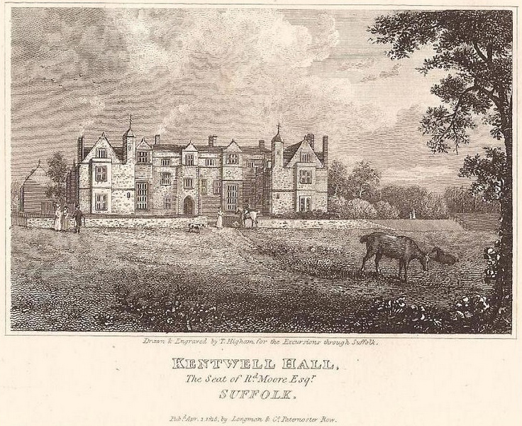
Kentwell was sold to Thomas Robinson c. 1676 who made considerable alterations to the house. In 1706 his grandson Sir Thomas II sold to Sir John Moore (1620–1702), a rich city merchant who made his fortune in the East India trade. Kentwell stayed in the Moore family until it was sold in 1823 due to the considerable debts built up by Richard Moore (1769–1826), partly from the costly changes he made to the mansion and estate.
Robert Hart Logan (1772–1838) bought the 793ha (1,960a) estate and went on to substantially remodel the house. After his sudden death it was acquired by the trustees of the young Edward Starkie Bence (1823–89), whose father owned the estate of Thorington in East Suffolk. Edward, who purchased a captain’s commission, held Kentwell for fifty years until his death in 1889. It stayed in the family for a further seventy years during which time it was mostly tenanted. During World War II Kentwell acted as a major transit camp. After the war Kentwell Hall and Park were eventually sold in separate lots. In 1969 much of it was bought in a degraded condition by Patrick Phillips who, with his family, set about its restoration. It remains in private ownership today.
KENTWELL HALL
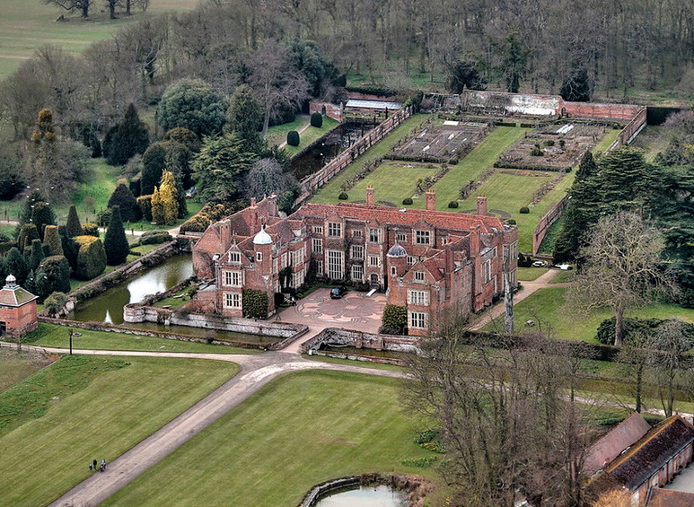
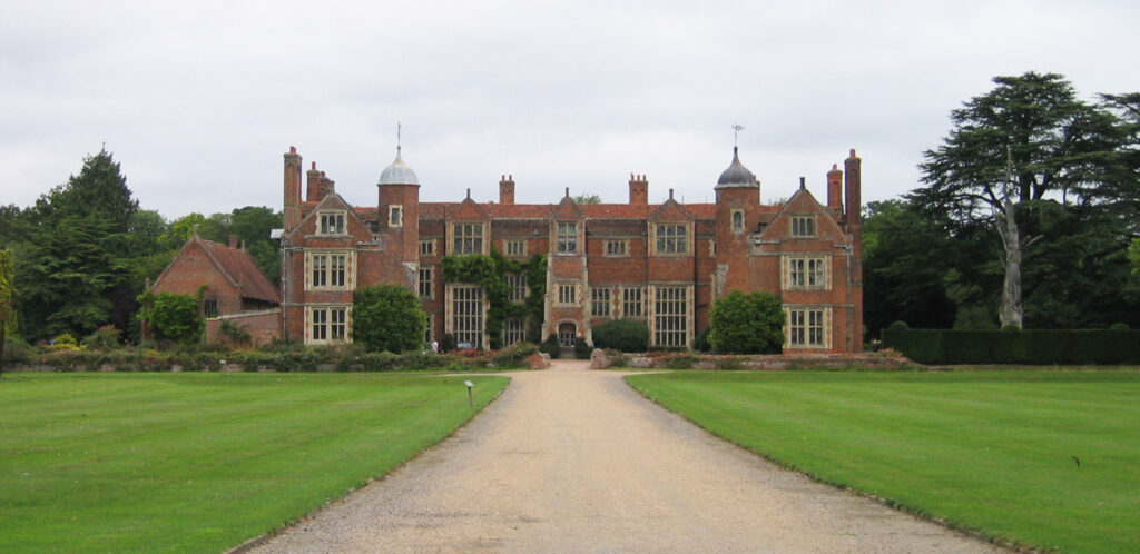
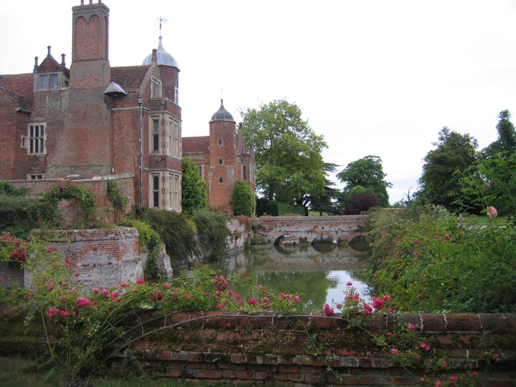
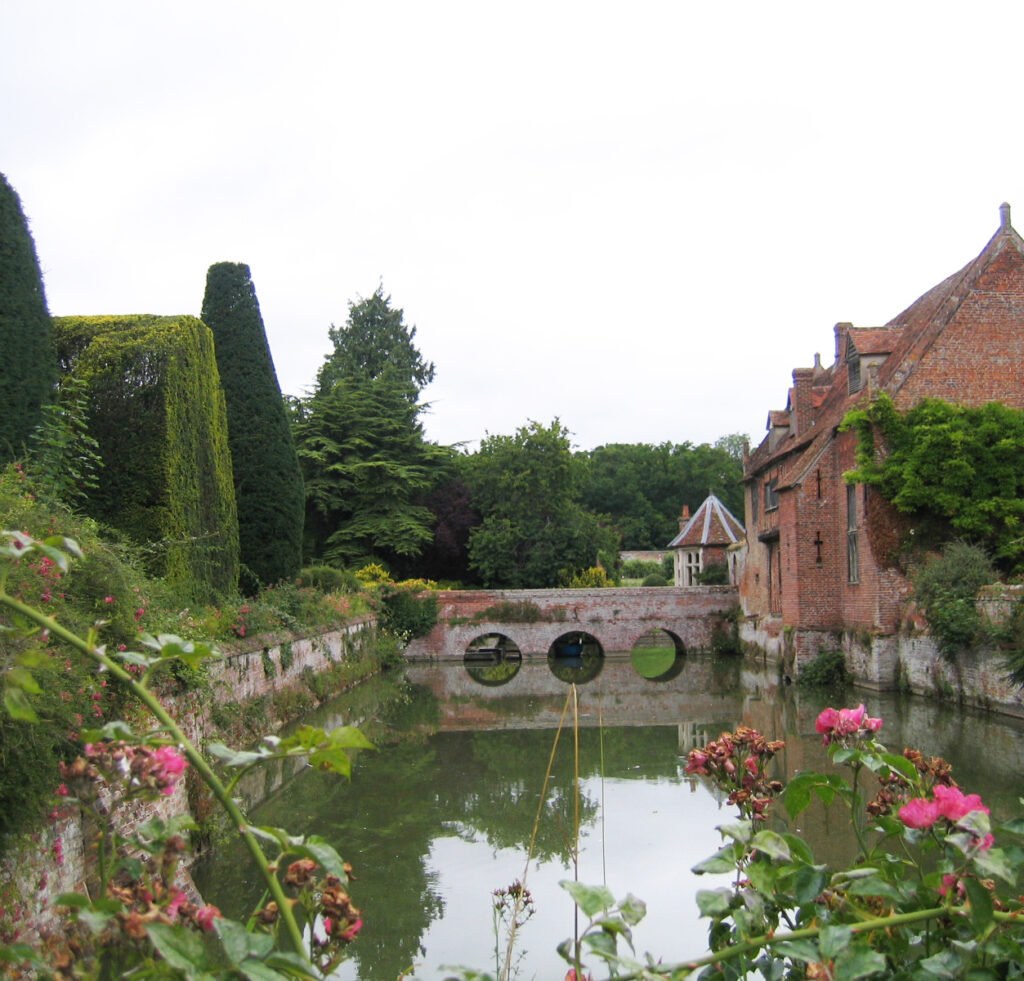
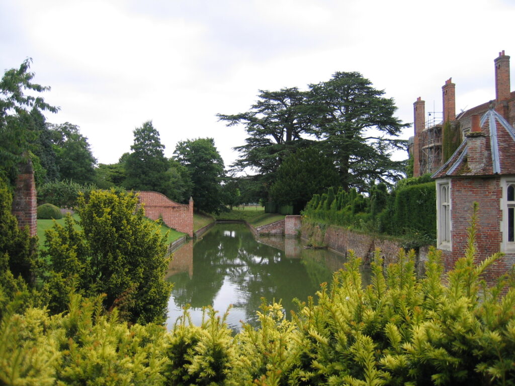
The present large, moated mansion was first built by 1563 and has gone through four or five stages to create a red brick house of E-shaped plan. It is surrounded by a moat with brick revetments and approached by two brick arched bridges on the south and west sides, which are included in the Historic England Grade I listing for the hall. At three-storeys high, Kentwell Hall has a main south front with two wings projecting to the south and central entrance porch. The wings have large octagonal turrets with domed roofs at their southern ends facing the open courtyard.
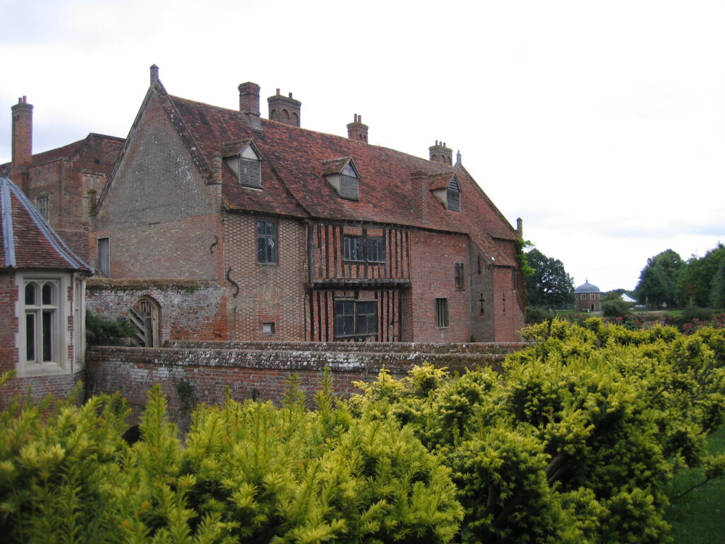
Adjacent to the house to the west is a group of buildings that project over the moat, one with jettied upper floor with exposed timber framing, that are thought to be part of the service buildings of the earlier fifteenth century Luton’s Hall.
KENTWELL HALL PARK
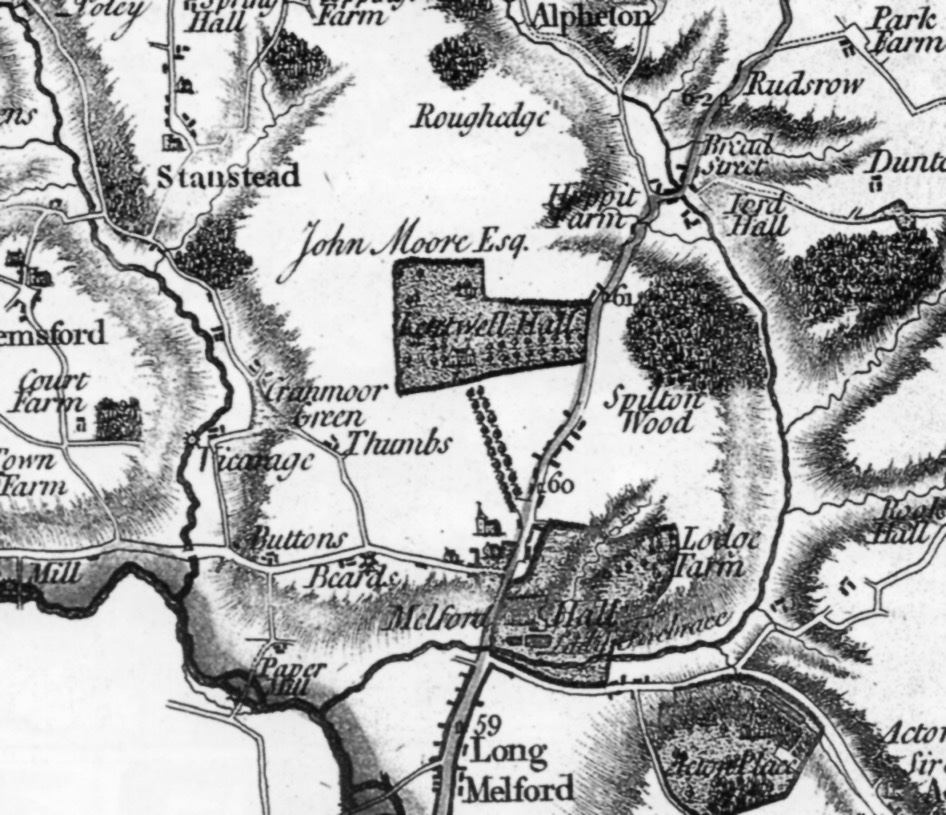
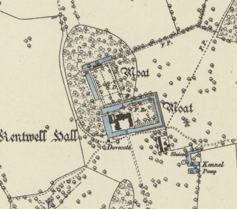
Although a deer park at Kentwell is mentioned in a document dated 1251, the present roughly triangular-shaped landscape park has seventeenth century origins. When Kentwell was bought by Thomas Robinson in 1676 the sales particulars described it as having ‘150 acres [60.7ha] of park, orchards, gardens and yards’. It was acquired by Sir John Moore in 1706 and had passed down to Henry Moore, whose will of 1773 states it had ‘park enclosed, dovehouse, gardens and fishponds’.
Ten years later Hodskinson’s map shows an L-shaped park to the west and north of the mansion with a further section of park extending eastwards to join the Sudbury to Bury St Edmunds road. This included the main entrance to the mansion site with an avenue of trees flanking the road – its route had been the main entrance to the site from before the Cloptons acquired the land to the south after the Dissolution of the Monasteries in 1540. Both a 1613 map of Kentwell Hall for Sir William Clopton and survey of the estate of Richard Moore, Esq. dated 1777 show this drive to have been a public road that ran east to west a short distance south of the moated Kentwell Hall. Hodskinson’s map also shows an avenue of trees centred on the house running south through fields beyond the park boundary towards the church in Long Melford. This is the route of the lime avenue of today’s main drive, which is believed to have been planted by Thomas Robinson in 1678.
The Moore family went on to substantially develop the park in the late-eighteenth and early-nineteenth centuries. Between 1787 and 1805 Richard Moore took in the land to the south to create his landscape park. The original public road serving as the main drive to the house was removed c. 1783 specifically to make way for Richard’s park. It is believed he consulted Humphry Repton (1752–1818) about plantings in the park and Repton’s involvement appears to be confirmed by a drawing of Kentwell he made in 1797 that appeared in Peacocks Polite Repository or Pocket Companion. Woodland north-west of the house was extended between 1783 and 1838 creating today’s ‘Pond Plantation’ surrounding an elaborate series of fishponds that were originally within the medieval park. These were described as functioning in 1676 when Kentwell was sold to Thomas Robinson and have been suggested as ornamental ponds possibly around an earlier house.
Richard Moore’s debts were partly due to the changes he made in the park forcing the Moore family to sell to Robert Hart Logan in 1823. Robert is recorded as having made substantial changes to the house. At his death in 1838 the park was described in sales particulars as beautifully timbered and extending to just over c. 121ha (300a). A year later the tithe map shows that the old east to west avenue had gone and the southern drive and avenue became the main entrance. However, it terminated c. 100m (328ft) south of the mansion at the junction of the parkland and pleasure gardens.
Possibly as a result of Repton’s involvement, freestanding trees, groves and clumps of trees are shown on the tithe map dotted around the park. ‘Pond Plantation’ to the north-west had three fishponds, ‘Hare Wood’ (now Hare Grove) beside the home farm and ‘New Wood’ (now Paddock Plantation) to the north. How much of what can be seen on the 1839 tithe map was solely the work of the Moore family is unclear, although it seems likely Robert had a hand in developing the park further when he was making changes to the house.
During the nineteenth century areas of the park were turned over to arable with the Bence family’s park broken up when Kentwell was sold in lots in 1969. Since then the present owners have been acquiring additional land around the house and progressing with the park’s restoration.
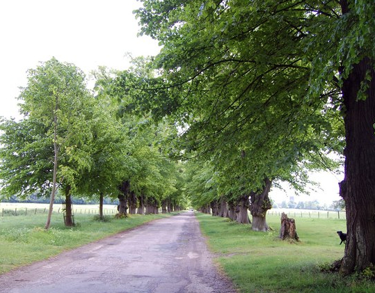
At the end of the twentieth century the landscape park extended to c. 52ha (129a), less than half the size it had been at the beginning of the nineteenth century. However, it retains a number of features from that period. Level to east and north, the land falls gently south and westward giving views of the church from points along the main c. 1km (0.6ml) long southern approach drive and avenue. It now consists of lime trees of various ages, including some nineteenth century trees when it was extensively replanted.
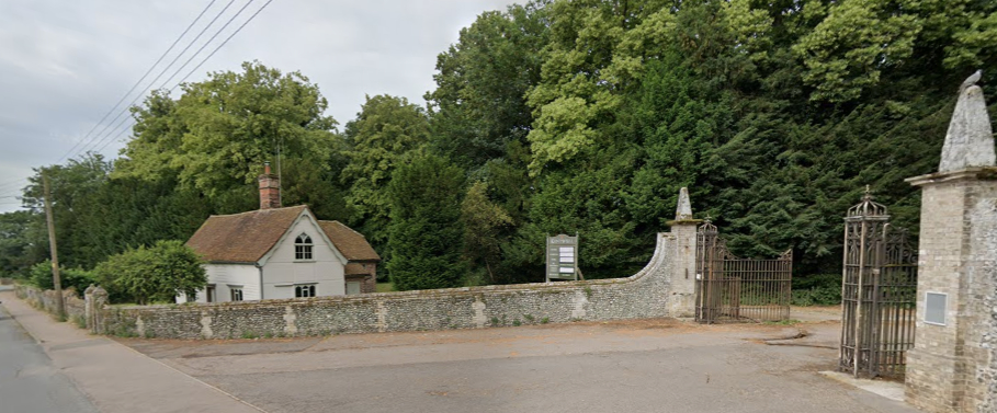
At the northern end of the avenue two twentieth century octagonal lodges with wrought-iron fencing and elaborately decorated gates mark the boundary of the park and the pleasure grounds. The gates are dated to the late-eighteenth century and were purchased from Earlham Hall in Norfolk in 1913. However they were originally used for the road end of the drive, but have now been moved to much nearer the mansion and a newer set of gates hang at the south end of the avenue, where a small rustic lodge stands that has fifteenth century origins, but was later encased by a Gothic Revival-style building (Grade II) in the early-nineteenth century.
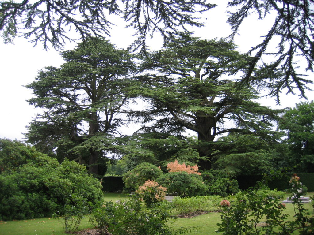
Today remnants of Richard Moore’s perimeter tree belts survive, particularly to the eastern boundary. Near the house to the west of the lime avenue there are a few surviving veteran parkland oaks, possibly from the seventeenth century, augmented by late-twentieth century clump plantings. At the end of the twentieth century the eastern section of park had the largest number of surviving veteran parkland trees, but almost none survive today. A few are to be found in the parkland to the north of the mansion.
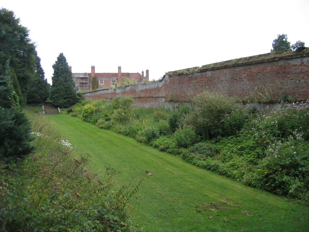
To create a more formal approach to the house, lawns, also known as plats, a brick ha-ha and gate screen were added outside the moat on the south front in the late-twentieth century. The stable yard, shown on the 1839 tithe map to the south-east of the moat has been developed as a café and events area. Arable land lies beyond the park’s western boundary and to north it is arable and woods.
GARDENS AND PLEASURE GROUNDS
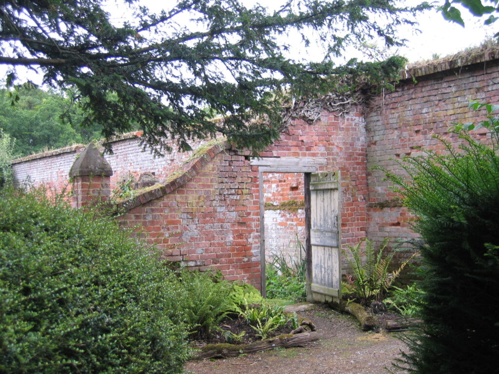
Today the pleasure gardens around Kentwell Hall cover 6.5ha (16a) in total and are believed to date from the mid-sixteenth century, although with no early map evidence their origins are difficult to define. They include the gardens within the house moat and a moated garden to the rear of the house surrounded by an oval-shaped enclosure with a mature yew walk from the seventeenth century or earlier bordered by shrubberies and woodland with winding paths. An early-eighteenth century square dovecote (Grade II*) is just outside the house moat near its south-west corner. It is said to be the largest in Suffolk and has over one hundred and forty brick built nesting boxes on each wall with an access ladder which revolves on a central post. There is more recent landscaping to the south and planting established by the present owners to the north-east, east and south-east. This includes topiary yews in the shape of a castle, avenues, late-twentieth century lime trees and clumps of trees around the old stables, now a café complex.
GARDENS WITHIN THE HOUSE MOAT
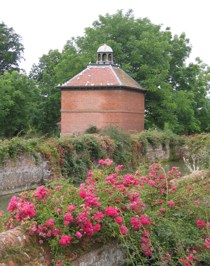
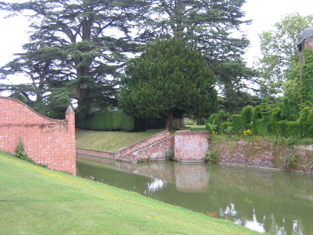
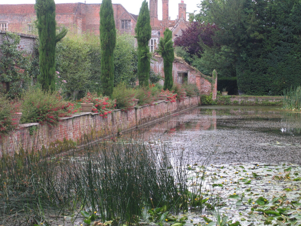
The main moat surrounding the house was originally smaller with surviving octagons at each inner corner, but was extended eastward during the seventeenth and eighteenth centuries. In the early-eighteenth century the north-west octagon was converted to a summerhouse, although now its windows have been boarded so it can be used as a camera obscura. The main access to the mansion is a bridge to the south and a secondary bridge spans the western arm of the moat at the north-west corner connecting to the pleasure gardens west of the moat.
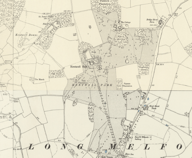
The 1884 OS map shows the house lying off-centre to the west within the rectangular house moat, its eastern arm water-filled. The eastern half is a garden on a platform with steep grass sides down to the moat rather than brick revetments that occur in the section around the house. A map dated 1842 shows flower beds of a geometric design in this area, which today includes a yew-hedged enclosure laid to grass with twentieth century flower beds edged by cedars that were planted c. 1800.
MOATED GARDEN TO THE REAR OF HOUSE
To the rear (north) of the house a secondary moat, once connected to the house moat, encloses an area c. 100m (328ft) by 85m (279ft). A garden within it is enclosed by high brick walls, except its southern side which is left open to allow views from the house over the garden. This moat is believed to be derived from a sixteenth century enclosure and not shown as a water-filled moat on the 1839 tithe map. However, a map, probably dated to the late-eighteenth century, is believed to be the first cartographic evidence of a moated enclosure in this area.
The 1884 OS map shows two sides of the moat as water-filled. Its western arm, called ‘Fish Pond’, has been truncated to the north and south to give access causeways into the moated garden and forming a canal-like feature. The map shows an area of frames is positioned at the northern end of this feature and remain part of the present gardens. The northern arm is called ‘Back Moat’ because of its gloomy appearance created by encroaching deciduous woodland. The eastern moat arm is dry, creating a sunken garden. Today it is laid to grass with herbaceous borders.
Inside the walled garden a structure is shown on the 1838 map attached centrally to the north wall suggesting a lean-to glasshouse, possibly for plant rearing or perhaps an orangery. By 1884 the glasshouse had either been extended further west, or replaced by a longer range of glasshouses. In 2017 these lay in a degraded state, as were the sheds attached to the outside of the north wall.
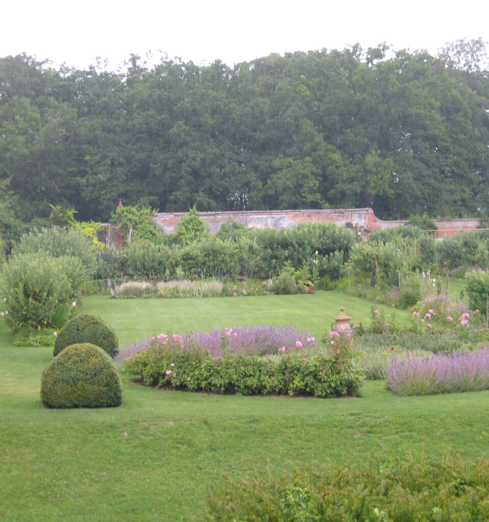
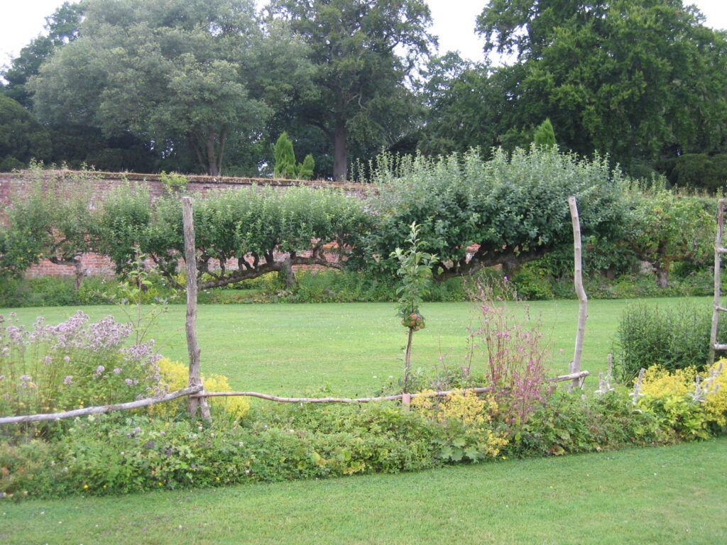
Within the garden, perimeter and cross-paths, some lined with very mature espaliered fruit trees and box-edged borders, lead to gateways to outside areas. At the end of the twentieth century this garden had been re-established as a kitchen garden containing grass, flowers for cutting, herbs and vegetables.
Today Kentwell’s gardens and pleasure grounds consist of a combination of historic features, elements of substantial alterations by Lady Guthrie, a tenant in the 1930s, and more recent landscaping by the present owners. Most of the late-nineteenth century features shown on the 1884 map have either survived or been restored in a modified form.
SOURCES:
Copinger, W. A., The Manors of Suffolk, Vol. 1, 1905.
Cromwell, Thomas, K., Excursions in the County of Suffolk, Vol. 1, 1818.
Hoppitt, Rosemary, Deer Parks of Suffolk 1086–1602, 2020.
Peacocks Polite Repository or Pocket Companion, 1797.
Pevsner, Nikolaus and Radcliffe, Enid, The Buildings of England: Suffolk, 1975.
Sandon, Eric, Suffolk Houses A Study of Domestic Architecture, 1977.
Williamson, Tom, Suffolk’s Gardens and Parks, 2000.
Williamson, Tom, Kentwell Hall, Suffolk, (UEA Report 1994).
Kentwell Hall on-site information board (June 2017).
Kentwell Hall website: https://www.kentwell.co.uk/the-history (assessed December 2022).
https://landedfamilies.blogspot.com/search?q=Kentwell (accessed November 2024)
1783 Hodskinson’s Map of Suffolk in 1783.
1839 tithe map and apportionment.
1884 (surveyed 1884) OS map.
1905 (revised 1902) OS map.
1928 (revised 1924) OS map.
Heritage Assets:
Suffolk Historic Environment Record (SHER): LMD 005, 077.
Kentwell Hall (Grade I), (including building to west, brick revetment of moat and two bridges). Historic England No: 1183113.
Church of the Holy Trinity (Grade I). Historic England No: 1182550.
Trinity Hospital (Grade I). Historic England No: 1036554.
Kentwell Hall Park and Garden (Grade II), Historic England’s Parks and Gardens Register No: 1001169. (https://historicengland.org.uk/listing/the-list/list-entry/1001169?section=official-list-entry)
Dovecote to south-west of Kentwell Hall (Grade II). Historic England No: 1351844.
Kentwell Lodge (Grade II). Historic England No: 1183097.
Suffolk Archives (formerly Suffolk Record Office):
(SA) HA505. Bence family of Kentwell Hall including Moore and Starkie Bence families of Kentwell Hall, 1500–1937.
(SA) HD11:475/387 & 8. Map of Kentwell Park, nd (probably late-eighteenth century).
(SA) HD11:475/385. Map of Kentwell Park Montagues, nd (probably late-eighteenth century).
(SA) HA505/3/1. Plan of Kentwell estate, 1838.
(SA) HA 505/3/13. Sale particulars, 1839.
(SA) Q/SH 71. Footpath diversion plan, 1870.
Site ownership: Private
Study written: January 2026
Type of Study: Desktop and site visits in 2015 and 2017
Written by: Tina Ranft
Amended:
