(Hall demolished 1955)
Parish: BOULGE
District: EAST SUFFOLK (previously Suffolk Coastal)
TM 254 527
Not open to the public except on public footpaths through the park
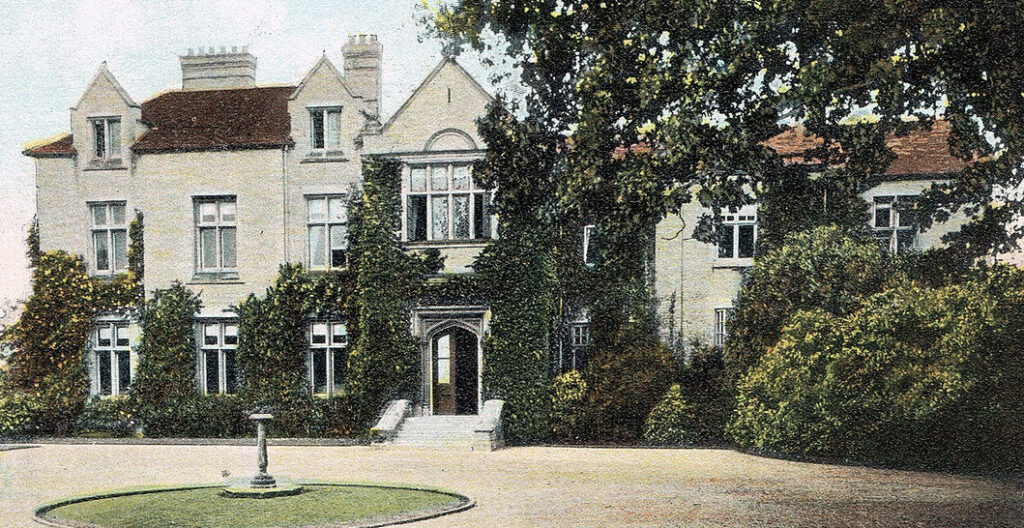
The small, sparely-populated parish of Boulge lies c. 4km (2.5mls) north-west of Woodbridge in an area referred to as ‘Ancient Rolling Farmlands’ on Suffolk County Council’s Landscape Character Assessment. The site of demolished Boulge Hall is east of a small river that flows southward towards the River Deben. It lay close to the charming Church of St Michael and All Angles (Grade II). The church has early-English origins, sixteenth century tower but was much replaced and rebuilt in the mid-nineteenth century. This is one of many ancient manorial sites in Suffolk where the church and manor house stood close together, with evidence from fieldwalking in 1988 that there had been a settlement close by that may have been abandoned to make way for the landscape park created for Boulge Hall c. 1800. Bordering the park to the south-west lies the ancient woodland of Boulge Wood.
Hodskinson’s 1783 map shows the isolated church, but with no obvious hall, which was built for William Whitby who died in 1792. The secluded site is shown on an estate map dated 1810 to be within a large landscape park of c. 55ha (136a) that is believed to have been created at the end of the eighteenth or beginning of the nineteenth centuries by the Fitzgerald family.
During the first half of the nineteenth century it was owned by Mary Frances (b. 1779), the daughter of John Fitzgerald of Kilkenny in Ireland. In 1801 Mary married her first cousin John Purcell (1775–1852) the son of Dr John Purcell, a Dublin physician. Mary’s husband John took the name Fitzgerald by royal licence in 1818 following the death of her father when she inherited his numerous estates and became hugely wealthy.
Initially they made their home at the neighbouring White House (also known as Bredfield House) in Bredfield. It is said that Mary’s father had bought Boulge Hall for the couple but they were unable to move to the Hall because Eleanor, the widow of the William Whitney, who had remarried to become Mrs Short, had a life interest in the house. However she appears to have preferred to live in Boulge Cottage, a house on the edge of the park by the south-east park gates that was built c. 1800 and is now called Boulge House.
After the death of Eleanor in the 1830s, the Fitzgerald couple were able to take possession of Boulge Hall. However, prior to that John and Mary had moved in 1826 from the White House to live at Wherstead Park, a house closer to Ipswich with a fine view of the River Orwell and opposite Orwell Park, the home of their landlords the Harland family.
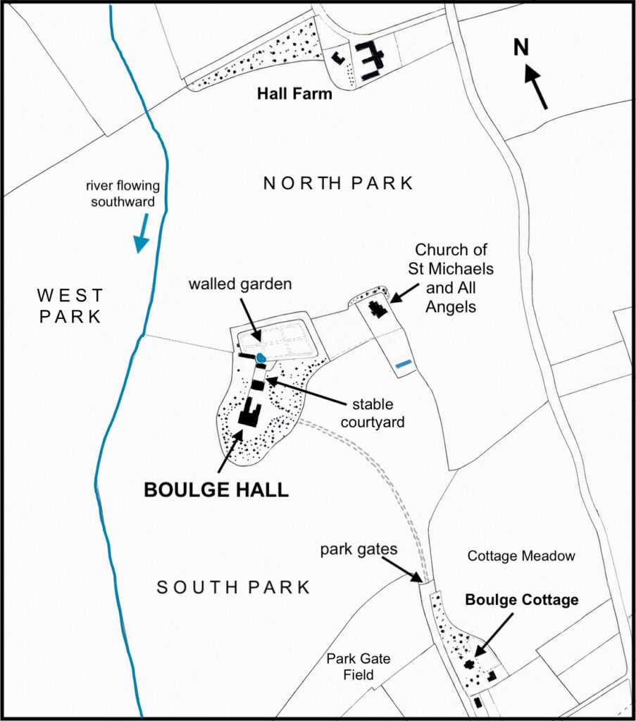
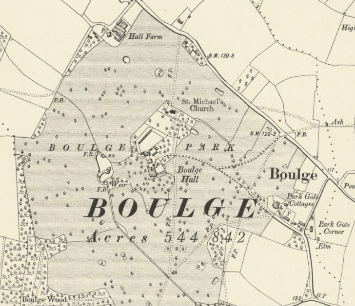
John and Mary finally moved into Boulge Hall in 1835, although they spent most of their time apart because Mary, unlike her husband, disliked country life, preferring to spend her time at their London and Brighton homes or travelling in Europe. The 1838 tithe map shows the property they moved to. Surrounded by parkland that extended to the west of the river, it had a single drive with the entrance and park gates to the south-east. The house had two wings attached to a main square wing that had the principal garden elevation facing south. It lay within an irregular oval-shaped garden enclosure with stables to the north and trapezoid walled garden separated into six sections by perimeter and cross-paths beyond.
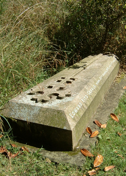
The most famous of their sons, Edward Fitzgerald (1809–83) the poet and translator of the Persian poem The Rubaiyat of Omar Khayyam, shunned the life of his parents and moved to Boulge Cottage until 1853 when he found a home in Woodbridge to be closer to his friends. In addition to the grand Fitzgerald Mausoleum (Grade II) in the churchyard of the Church of St Michael and All Angles, there is a monument to Edward (Grade II) in the shape of a simple coffin beside the family mausoleum with a rose, said to be from the tomb of Omar Khayyam, planted beside his grave.
On the death of Mary Frances in 1855, the estate passed to the eldest son John who was well known for his eccentric ways. The Fitzgerald family are said to have made a number of changes to the parkland and gardens at Boulge during the nineteenth century.
John died in 1879 and the estate was retained by the executors of his will until 1890 when it was sold to Robert Holmes White (1834–1901), a London solicitor and son of John Meadows White who came from a prominent East Anglian family. It is believed that Robert bought Boulge Hall Estate for his son Robert Eaton White, who was created a baronet in 1937. Soon after the purchase there followed more substantial alterations to the house and gardens, many documented in correspondence and other papers that were deposited in Suffolk Records Office, today Suffolk Archives. At the same time the estate was expanded.
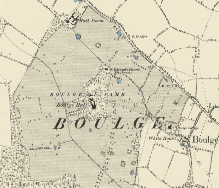
It is unclear whether it was the Fitzgerald or White families who introduced a major new entrance drive from the east, which appeared between 1838 and 1887, that linked up to the earlier south-eastern drive. Other changes included a track from the south, another track linking the house with Hall Farm to the north and a track from the north leading to the church. The 1887 OS map shows the parkland with trees marking old field boundaries and clumps and freestanding trees dotted throughout. To the east of the Hall, the remnants of an avenue of trees from the south suggest the route of an earlier track.
By 1887 the garden enclosure around the house had been regularised with straight edges. An avenue centred on the house with parkland on either side led out to the river with the western park beyond. Slip gardens planted with fruit trees surrounded the walled garden on three sides and there was an orchard between the walled garden and church.
In 1893 the architect Gambier Parry was paid the large sum for the time of £1,299 for ‘Garden and Terraces’. This included the removal of existing formal beds and adding a terrace overlooking lawns with specimen trees down to a newly-constructed kidney-shaped lake to west. This was created by damming the river and adding a weir. A small curved peninsular partially divided the lake that was accessed from the gardens over a footbridge beside the weir.
Two years later new slip gardens were developed around the walled garden and a new gardener’s cottage, fruit store and potting shed were built. In 1896, once the main construction period was over, a number of plants were supplied by London firm of Lee, Veitch and Waterer to begin the planting process. The documents in Suffolk Archives include a reference to a Dutch garden, an evergreen tree walk, a ‘flower-bed lawn’, poplar border and a ‘wilderness’, which usually denotes a woodland walk. In addition there was a nut tree walk, rhododendron bed, new herbaceous border with box edging, summerhouse, two new tennis courts and vineries attached to the inside of the west wall of the walled garden and constructed by the Norwich firm of Boulton & Paul, who were internationally famous for their high-quality wooden and iron garden structures. Works to the house included the installation of electric lighting and parquet flooring.
During World War II much of the parkland was converted to arable fields. One year after the start of the war Sir Robert White died but it was not until the end of the war in 1945 that the house with c. 6.5ha (16a) of gardens and the c. 344ha (850a) Boulge Hall Estate was for sale. At the time sales particulars described the house as ‘comfortable’ and in good repair.
Eventually it was sold to Corpus Christ College, Cambridge and in 1955, after suggesting repairs would be too costly, Boulge Hall was demolished in September of that year, leaving just the walled garden, some garden sheds and the stable block surviving. It is unclear if the requirement to retain the stable block clock and gate piers required by the Ministry of Housing was conformed to. An auction of salvaged materials soon followed.
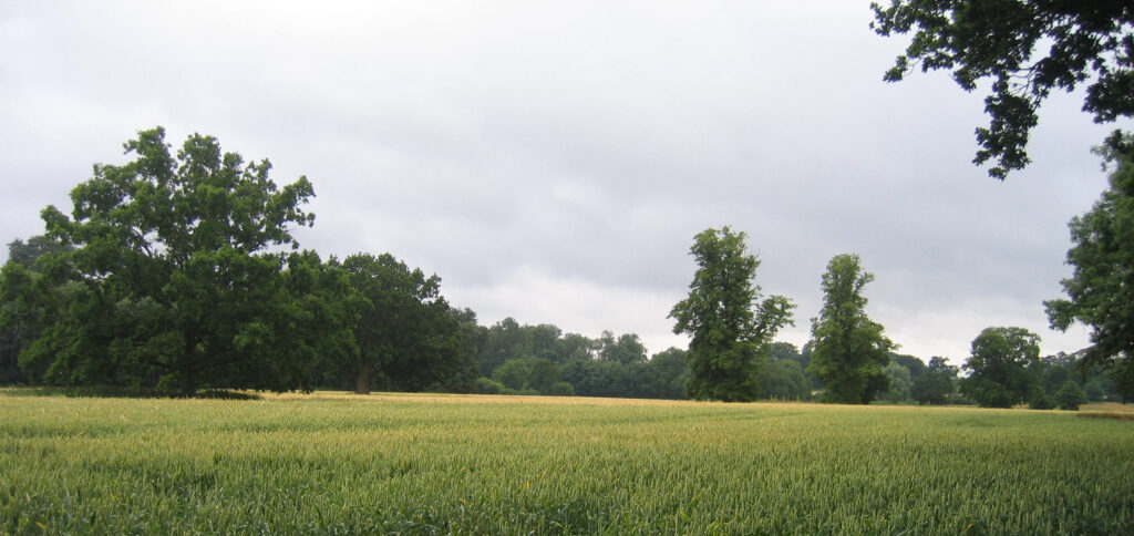
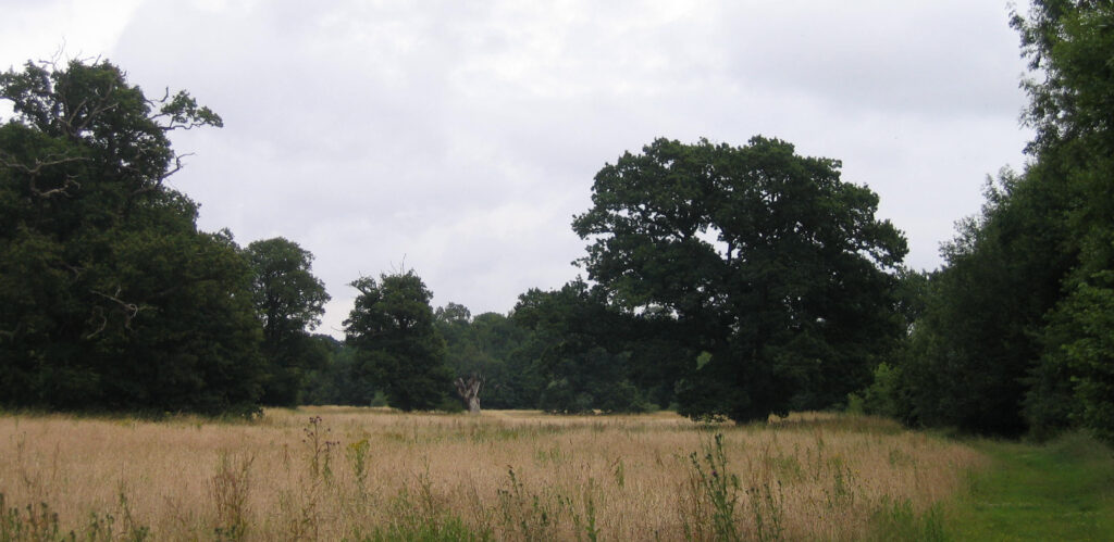
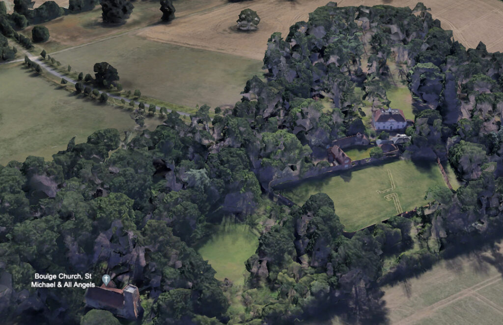
Sometime after 1995, when Suffolk Coastal District Council produced a Supplementary Planning Guidance report on Boulge Hall Park, a new house developed on the site of the stable block. However, the site retains the outline of the nineteenth century garden enclosure with a number of mature specimen trees surviving around the edge of the enclosure, such as sequoia, beech, cedar, pine, yew, oak and evergreen shrubbery. Much of the parkland was converted to arable, although some nineteenth century parkland trees have survived, including oak, cedar, lime and beech plus a few oaks that pre-date the creation of the landscape park. More recently some of the arable fields have been converted back to parkland for the benefit of a new game shoot.
SOURCES:
Copinger, W. A., The Manors of Suffolk, Vol. 7, 1910.
Kirby, J., The Suffolk Traveller, 1735.
Page, Augustine, Topographical and Genealogical, The County of Suffolk, A Supplement to the Suffolk Traveller (of J. Kirby), compiled 1811 and published in 1847 by Page, Joshua.
Pevsner, Nikolas, The Buildings of England: Suffolk, 1974.
Roberts, W. M., Lost Country Houses of Suffolk, 2010.
Suffolk Coastal District Council, SPG No 6, December 1995.
Walford, Edward, The County Families of the United Kingdom…, 1864.
Williamson, Tom, Suffolk’s Gardens and Parks, 2000.
Wright, William, Aldis, Dictionary of National Biography, 1885–1900, Vol. 19.
https://suffolklandscape.org.uk/landscapes/ancient-rolling-farmlands/ (accessed July 2026).
https://en.wikipedia.org/wiki/John_Fitzgerald_(1775–1852) (accessed July 2026).
http://www.historyofparliamentonline.org/volume/1820-1832/member/fitzgerald-john-1775-1852. (accessed July 2026).
Census: 1851, 1881, 1901.
Maps:
Hodskinson’s Map of Suffolk in 1783.
1838 (surveyed 1838) tithe map and apportionment.
1887 (surveyed 1881) Ordnance Survey map.
1905 (revised 1902 to 1903) OS map.
1928 (revised 1925) OS map.
Heritage Assets:
Suffolk Historic Environment Record (SHER): BOU 007, BOU 008, BOU 009, BOU 026.
Church of St Michael and All Angels (Grade II). Historic England No: 1284161.
Fitzgerald Mausoleum in the Churchyard of St Michael (Grade II). Historic England No: 1377191.
Monument to Edward Fitzgerald in the Churchyard of St Michael (Grade II). Historic England No: 128461.
Suffolk Archives (previously Suffolk Record Office):
(SA) HB56. Purcell-Fitzgerald family of Boulge Hall, deeds and estate papers, 1700–1900.
(SA) HD11/475/Boulge/299. Boulge Hall Estate, John Fitzgerald Esq.. proprietor, details of Hall and grounds, lawns, plantations, rockery, field names…, 1810.
(SA) HD11/475/236. Boulge Cottage, Mrs Short, detail of road to Bredfield, adjoining land, March 1818.
(SA) HD11/475/Boulge/230. Boulge Hall pencil draft showing conservatory in relation to adjoining property, c. 1833.
(SA) HD11/475/Boulge/231. Diagram of situation of Boulge Hall, 1 May 1834.
(SA) HA244/x/5/1. Garden Diaries, Boulge Hall, 1896.
(SA) HA244, supplement 3, document 1483; Bidwells, Sale Particulars, 29 May 1945.
(SA) HA244/D1/H; HA244 c/26/2; HA244 c/26/3; HA 244 x/5/1.
(SA) HE402/1/1955/3. Catalogue of the remaining contents of Boulge Hall, 15 April, 1955.
Site ownership: Private
Study written: July 2026
Type of study: Site visit to church and parkland 2015 and desktop.
Written by:
Amended: