Parish: HENGRAVE
District Council: WEST SUFFOLK (previously St Edmundsbury Borough Council)
TL 823 685
Only open to the public for booked events
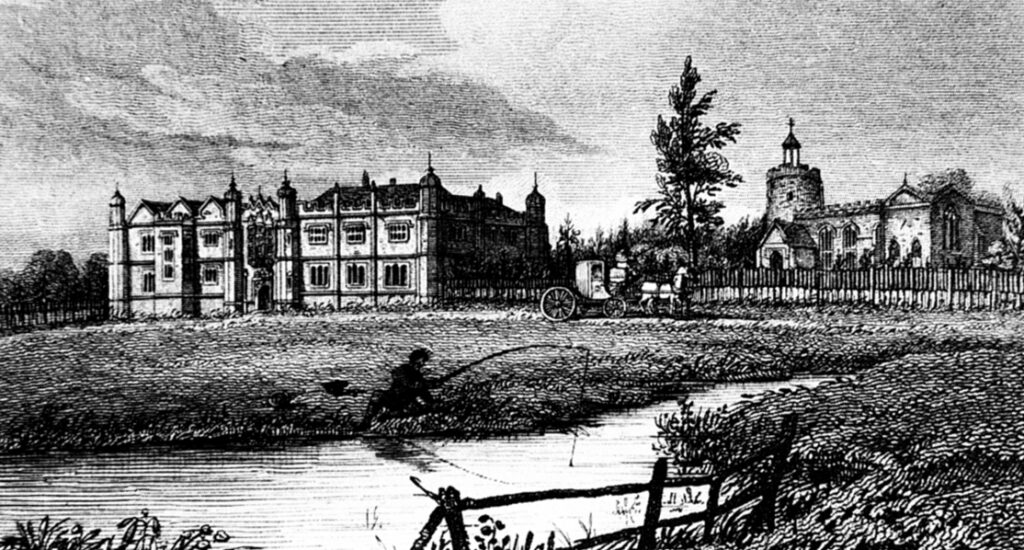
On the edge of Breckland, an area of sandy, free-draining soils, Hengrave Hall (Grade I) is c. 5km (3mls) north of Bury St Edmunds. It sits in a landscape park of mainly rich loam soil, which gently rises towards the south-west from the valley and floodplains of the River Lark and the eastern borders of Hengrave parish. The river passes through Bury St Edmunds as it makes its way north-westward towards Mildenhall and Prickwillow before joining the River Great Ouse near Littleport in Cambridgeshire. The parish of Fornham St Genevieve is on the opposite side of the river with the parishes of Fornham All Saints to the south and Flempton to the north. A section of the river was made navigable after a 1698 Act of Parliament, the work completed in 1716. A clause in the act gave the owner of Hengrave or their tenants free travel along the navigation without having to pay a toll. The ancient woodland of Hyde Wood is to the south.
OWNERS OF HENGRAVE
The manor, known as ‘Hemegreth’, was in the hands of the monks in Bury St Edmunds at the time of the Domesday book but was granted to Leo de Hengrave in the early-twelfth century. The de Hengrave family line died out in the fifteenth century and the manor eventually became the property of the Stafford family, Dukes of Buckingham, who were descendants of King Edward III.
Thomas Kitson, also spelt Kytson, (1485–1540) bought Hengrave manor and its manor house in 1521. It is one of many manorial sites in Suffolk where the manor house and church sit beside each other. The Roman Catholic Thomas was a cloth merchant who accumulated a huge fortune in London and became a landowner with properties in London, Suffolk, Devon, Somerset and Nottingham.
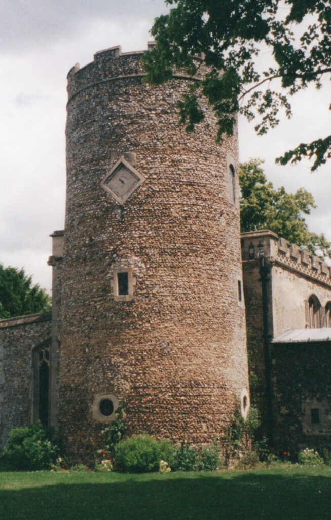
Thomas almost immediately started to build a new manor house close to the site of the original Hall beside the parish church known as the Church of St. John Lateran (Grade I). Thomas served as Sheriff of London, was knighted in 1533 and was Master of the Merchant Adventurers Company in 1534/35. Although a Roman Catholic, Thomas managed to move in royal circles and his work at Hengrave allowed him to live a luxurious, cultured lifestyle and acted as evidence of his newly-acquired rank in society.
The house and gardens were finally completed c. 1538, just two years before Sir Thomas died. Sources differ as to whether Sir Thomas’s son, also Thomas (1540–1603) inherited Hengrave on Sir Thomas’s death or whether it initially passed to his mother, Thomas’s widow Margaret.
Thomas junior was briefly imprisoned c. 1569/70 with his father-in-law, Sir Thomas Cornwallis of Brome Hall near Eye, who was also a Roman Catholic Recusant and failed to attend the services of the Church of England. His links to fellow Roman Catholic, the Duke of Norfolk, also acted against him. However, Thomas declared his loyalty to Queen Elizabeth, who had come to the throne in 1558, and was soon released.
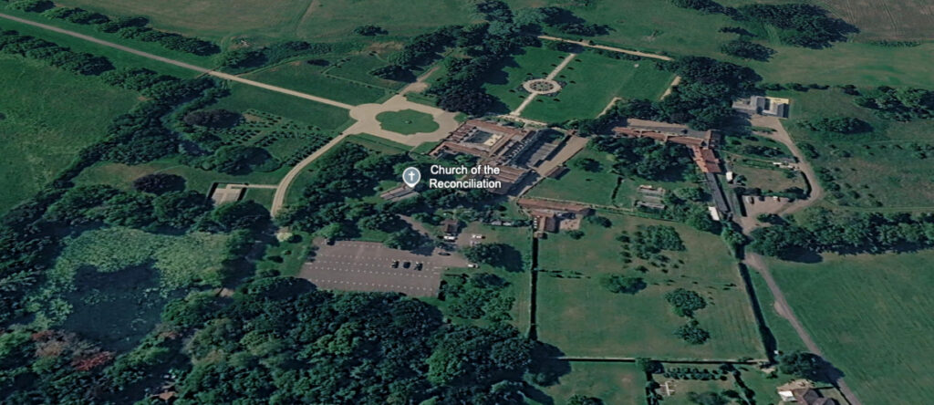
Work progressed on the house and gardens until it was fit for a three night visit by the Queen as she made her progress through East Anglia in 1578. In 1589 the church became a private chapel for Hengrave Hall when the parish of Hengrave was consolidated with Flempton. The church was renamed the Church of Reconciliation in the twentieth century.
After Thomas’s death in 1603, Hengrave was inherited by his daughter Mary, Countess Rivers (c. 1565–1644). Mary appears not to have lived at Hengrave as there are documents referring to Hengrave Hall and rights to hunt deer being leased out. In 1583 Mary married Thomas Darcy, 3rd Baron Darcy of Chiche in Essex. Mary spent much of her time in the court of Queen Elizabeth where she was known for her beauty and intelligence.
Hengrave passed down the Kitson female line to Penelope (d. 1661), who married Sir John Gage of Firle Place in Sussex. Penelope settled Hengrave on her third son, Edward Gage (1626–1706), who was created a baronet in 1662.
Hengrave Hall stayed with the Gage family, passing to the Rokewood (Rookewood) Gages, until the politician John Wood (1857–1951) bought the Hengrave Estate in 1897. John made expensive repairs and restored the house and gardens. Hengrave was used as a hospital for wounded soldiers during World War I and John was created a baronet soon after, becoming Sir John Wood. On John’s death in 1951 Hengrave was sold to the Religious of the Assumption, an international Roman Catholic community dedicated to the transformation of society through religion. They ran a convent school until 1974. The community continued to exist until 2005 when its Christian and conference centre closed due to the cost of necessary improvements to the site.
The present owner runs Hengrave Hall as a events and wedding venue and is believed to have sought permission to convert some of the existing buildings on the site into private housing.
HENGRAVE HALL AND ASSOCIATED BUILDINGS
Thomas Kitson bought the original manor house of Hengrave in 1521. Although thought to have had a moat at this time, accounts for the period record a John Hadenham as paid twenty shillings for digging the moat in 1525 and 1526. These accounts are part of the Hengrave Collection and held by Cambridge University Library. However, digging the moat could be interpreted as re-excavating an existing moat. At the same time Thomas began to build his new grand mansion that was completed c. 1538, much of it surviving today. It has a long south-facing front façade with polygonal turrets and grand canted bay window. The central ornate porch has octagonal turrets that are mirrored along the elevation.
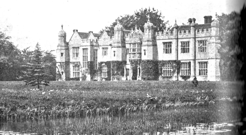
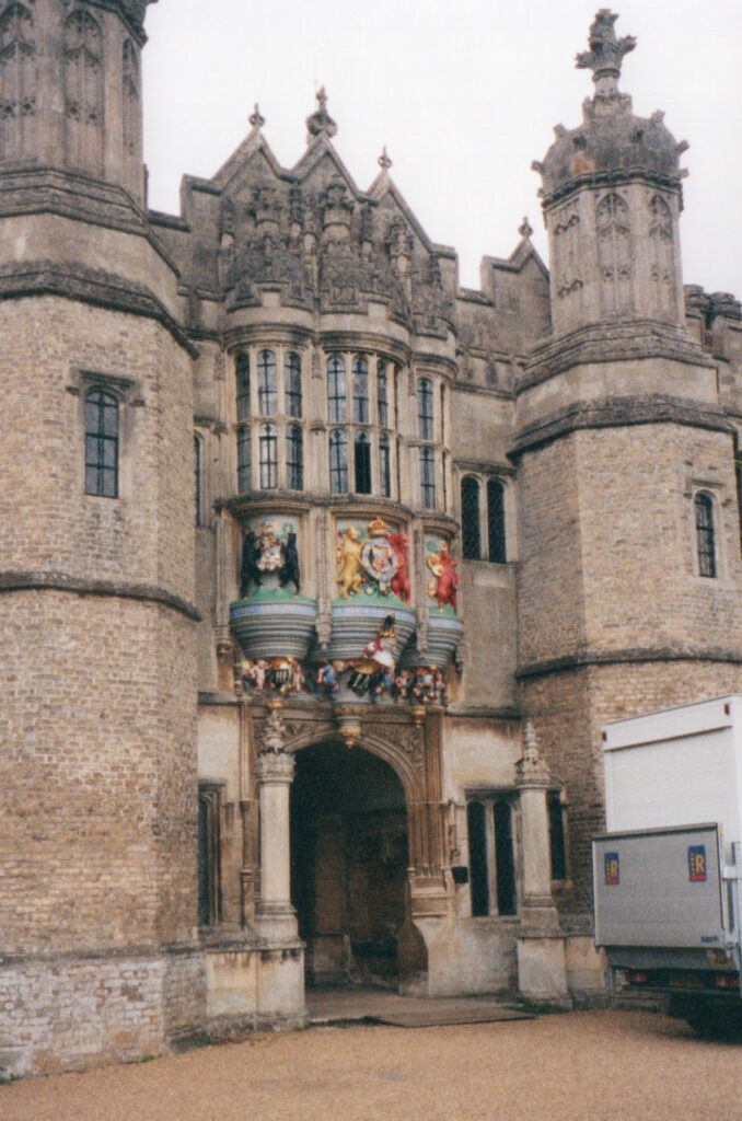
Hengrave Hall is built of Suffolk white bricks that are believed to have come from nearby Woolpit brickworks. The use of white as opposed to red bricks for such a large and grand house was unusual for the period and Hengrave may be one of the earliest examples. The battlements were added after a licence to crenellate was granted by Henry VIII in 1540, the year Sir Thomas Kitson died.
A drawing dated 1588 shows a plan of Thomas’s new Hengrave Hall. It depicts a large courtyard house with the main entrance to the south with a southern courtyard formed by buildings to the east, south and west sides to accommodate keepers, falconers and stabling for horses used for the pleasure of the family and visitors. The mansion had a separate servants’ wing and kitchen attached to the north-east corner. A further entrance accessed a northern garden and parkland beyond. This new house was built north of the original house and its moat.
Three remaining arms of the moat created a large outer entrance courtyard in front of the new mansion. Taxed on fifty-one hearths in 1674, Hengrave Hall is believed to have been by far the largest house in Suffolk at the time.
In 1755 the large mansion was reduced in size by a third with the removal of a tower and buildings to the north and east. At the same time its symmetrical front was altered. A survey map by Thomas Warren dated 1769 shows two sides of the ancient moat remained, the more eastern having been infilled. By this time the accommodation buildings and stables in front of the house had gone and the two enclosures south of the house opened up to form a large courtyard, with four clumps of trees marking the corners of the old outer courtyard.
A large barn once stood west of the house and is shown on maps of 1588, 1742 and 1769 with a ‘Dove House’ marked on the 1558 map on an island in the rectangular pond south-east of the mansion. By 1769 a new square building is shown west of the house that appears to be a new dovecote. Both had gone by the time the tithe map was surveyed in 1839, probably c. 1755 when major changes were made to the house. The western area became known as ‘Dovehouse Yard’ and converted for use as a garden.
The surviving stables (Grade II) are to the north-west of the house. They date from the early- or mid-sixteenth century and are two storeys high with gable projections. They had various alterations during the nineteenth and twentieth centuries. A photograph dated to the early-twentieth century in the Spanton Jarman Collection, the negatives held at Suffolk Archives and scanned by Bury St Edmunds Past & Present Society, shows them converted for vehicle storage with two attached cottages. Today they have been further converted for use as event accommodation with a laundry block linked to the north end.
John Wood (1857–1951) bought Hengrave Hall and estate in 1897 and began a major repair and restoration programme of the house that included adding a new annexe to the east for servants’ offices. He was also responsible for the restoration of the private chapel in 1898–9 and re-opened it for services in January 1900.
PARKLAND
Writing in 1822, John Gage (Rookwood, also spelt Rockewood) (1786–1842), notable historian, antiquarian and the youngest son of Sir Thomas Gage (1781–1820) of Hengrave Hall, suggested the ancient park associated with the pre-1571 house lay to the north-east and was later called ‘Little Park.’ A warrener, whose responsibly was keeping rabbits in a rabbit warren, is mentioned in expenses of Hengrave Hall during the 1570s, although the warren’s location is unknown but likely to have been on the sandy, free-draining soils to the north-west and possibly in the parish of Flempton.
By 1583 water features had developed north of the house taking water to the Hall from a spring head in ‘New Lay’, today a belt of trees known as ‘Bath House Covert’. It included two connected large ponds that would also have acted as fisheries.
When the licence to ‘empark’ a further c. 121.5ha (300a) was granted in 1587 the deer park was extended by taking in arable and pasture land to the south, west and into the parish of Flempton to the north-west. The following year over three hundred deer are recorded in Hengrave Park that came from a number of sites in Suffolk and Norfolk, including Chevington manor, another of the Kitson family’s properties c. 14.5km (9mls) to the south.
An undated photograph, from the late-nineteenth/early-twentieth century, in the Spanton Jarman Collection shows the south front of the house framed by two ancient oaks that lay to the south, possibly planted when the parkland was extended in the sixteenth century.
A map dated 1588 shows the extended park. The southern section contained c. 81ha (200a) with the house and associated buildings to the north-east. A tree-lined boundary fence divided the park into enclosures with names such as ‘Straungers Close’, ‘Long Close’ and ‘Clamp Close’. The main entrance was east of the house off the road between Fornham All Saints and Flempton hamlets, known today as Bury Road. The entrance drive passed kennels for hounds to arrive south of the church and the house.
A double avenue on the central axis of the house is shown on the 1588 map, although John Gage writing in 1822 suggests this was a triple row of trees fenced on each side with a deep ditch flanking a road raised above the surrounding land. This ran from the remains of the moat with a semi-circular ha-ha, now separated by a bridge, running south-eastward. The avenue stopped before reaching the park boundary and continued just as a track leading eventually to the edge of the park. Here there was a feature, presumably the viewing mount referred to in an indenture of 1587.
By 1588, two short avenues in the northern parkland passed through ‘Lyme Close’ towards the largest of the two connected ponds in ‘New Lay’. An area of sandy soils in Flempton parish to the north of the ponds is marked as parkland, although on the 1588 map it appears to have remained heathland. It seems likely that there were few trees in the park at this time because much of the park had been created from open arable land. An inventory also refers to boats, one on the moat and three on large ponds to the west of the house.
A map surveyed for William Gage in 1742 shows the development of the park since 1588. The north-west area of parkland called ‘Further Park’ was in closes and separated from the main deer park by a park pale fence.
By 1769, the map of that year shows a number of features, although it is unclear if these were existing or planned. The deer park had now become one large area to the south and west of the house dotted with freestanding and clumps of trees. Although some of the earlier formal features still remained, there was a much more of an eighteenth century landscape park feel. The formal features included the large pond and attached upper pond with a bath house or pump house in the belt of trees north of the house. One of the avenues shown on the 1588 map from the large pond ran towards the rear of the house, although the other avenue appears to have become just a track. John Gage suggests there was a vineyard or orchard, hop and hemp grounds and butts for archery practice on artificial mounds in an area he called the ‘upper park’, probably referring to parkland on slightly higher ground to the south of the mansion.
The dramatic avenue on the central axis of the house running south-east also survived in 1769. However, it appears to have become a single avenue plus ditches rather than the earlier double avenue. Part way along its length it changed to a wider avenue without ditches, with a circle of trees around the mount at the south-eastern park boundary. Close to the southern end of the ditches, a large round pond had appeared.
After crossing an almost parallel avenue, this pond connected to a track that joined a drive from the house site running in a southern direction towards the park boundary. These were not shown on the 1588 map before the park was expanded westward but had appeared by 1769 and are shown clearly on Hodskinson’s 1783 map of Suffolk. The southern avenue did not have a drive and continued beyond the parkland boundary to the ancient woodland of Hyde Wood, which survives today as a track known as ‘Queen Elizabeth’s Walk’. Writing in 2000, Tom Williamson refers to a few hornbeam stools from coppicing forming part of the narrow west belt of trees of the parkland boundary.
In 1777 Richard Woods (1715–79), a landscape designer working at the same time as Lancelot ‘Capability’ Brown, produced ambitious Hengrave plans for Sir Thomas Gage, 5th Bart. (1720–96). The park covering c. 121.5ha (300a) still had a number of geometric features and Richard suggested replacing the grand south-eastern avenue with a gently-curving entrance drive to the house. He also proposed flanking the southern entrance with clumps of trees and combining the large pond to the north with the narrower pond to make a more natural feature, possibly with a cold bath. In the event few, if not all, of Richard’s plans for the parkland were not executed at the time.
A survey map dated 1816 shows parkland to the south, west and north of the house bounded by the belt of trees in the area of the connecting ponds. Although marked as part of ‘Hengrave Park’ on the 1588 map and shown on Hodskinson’s 1783 map as parkland, the 1816 map shows the area north of the belt as still agricultural enclosures. The earlier dramatic avenue on the central axis of the house appears to have gone, leaving a track with just a few trees still standing along its route. Two large clumps of trees now flanked the southern end of the track near the viewing mount.
In 1816 the original entrance drive from the east passed immediately to the south of the church and house, curving around a western garden area to the stables, from where it continued onward to the southern entrance. Here a building flanked by clumps of trees is marked on the 1816 map, perhaps a response to the idea suggested by Richard Woods. This building must have acted as the entrance lodge, although it later became the home of the park keeper and was replaced c. 1840 by the present building, which again served as a lodge (Grade II) well into the twentieth century. An eastern entrance lodge is not shown on the map.
By 1816 a belt of trees bordered the road to the east and continued around the boundary of the parkland towards the viewing mount. An avenue north of the house is shown on the 1816 map which had developed from the original track leading to the southern end of the large pond. Freestanding and clumps of trees are shown dotted throughout the parkland.
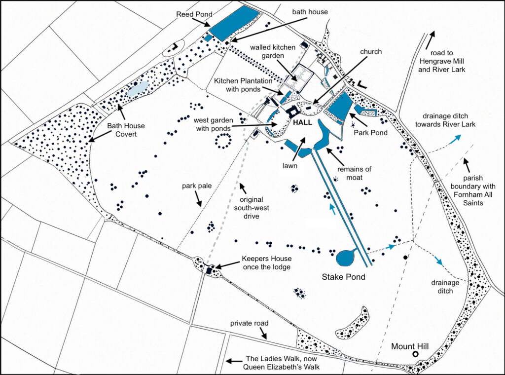
The tithe map and apportionment of 1839 show that little major change had taken place in the parkland over the previous twenty-three years. A bath house was now marked beside the large pond named as ‘Reed Pond’ that stood at the end of the short avenue leading to the rear of the house. This may date to c. 1777 as suggested by Richard Woods and is labelled ‘Pump House’ on a map of Hengrave by Thomas Warren dated 1797.
A fairly clear indication of the drainage system within the park is shown on the tithe map with water travelling in ditches from the higher ground to the south flowing north towards the house and eastwards towards the River Lark. It was collected in a large circular pond named ‘Stake Pond’ and fed through ditches, some lining the route of the original lost avenue, to feed the moat south of the house. From here water was diverted into ‘Park Pond’ close to the east entrance and to ponds west and north of the house.
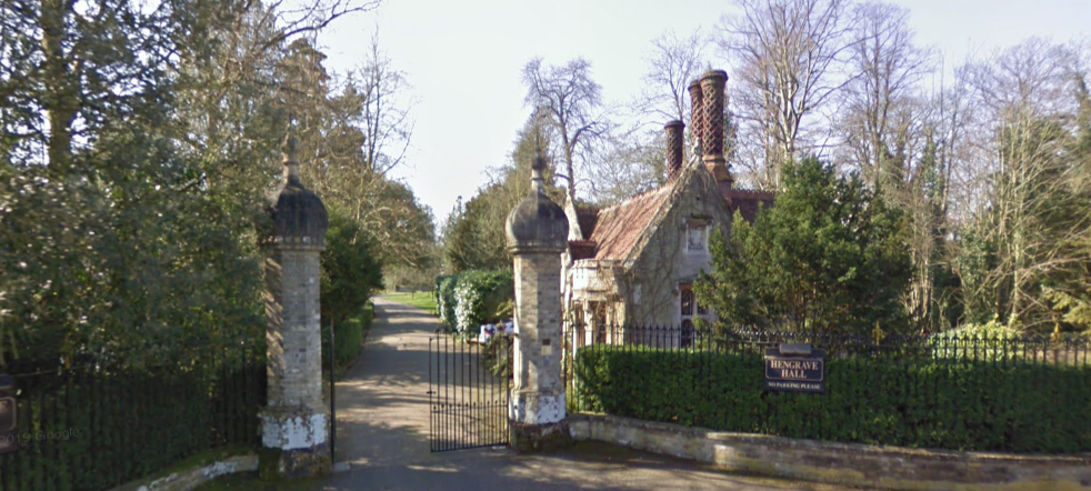
The tithe map also shows freestanding and clumps of trees dotted around the parkland and old field boundaries can be discerned by a few remaining linear field boundary trees. The early park pale survived at this time and the lodge to the south had become the ‘Keeper’s House’, with the drive now a track leading around the gardens north of the house. The surviving east lodge (Grade II) and entrance gates, piers and railings (Grade II) do not appear on the tithe map and are believed to have been added in 1848, the date on a plaque over the door of the lodge with the arms of Thomas Gage.
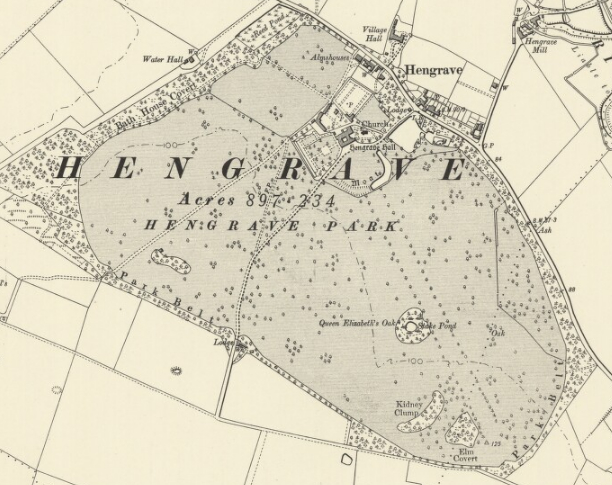
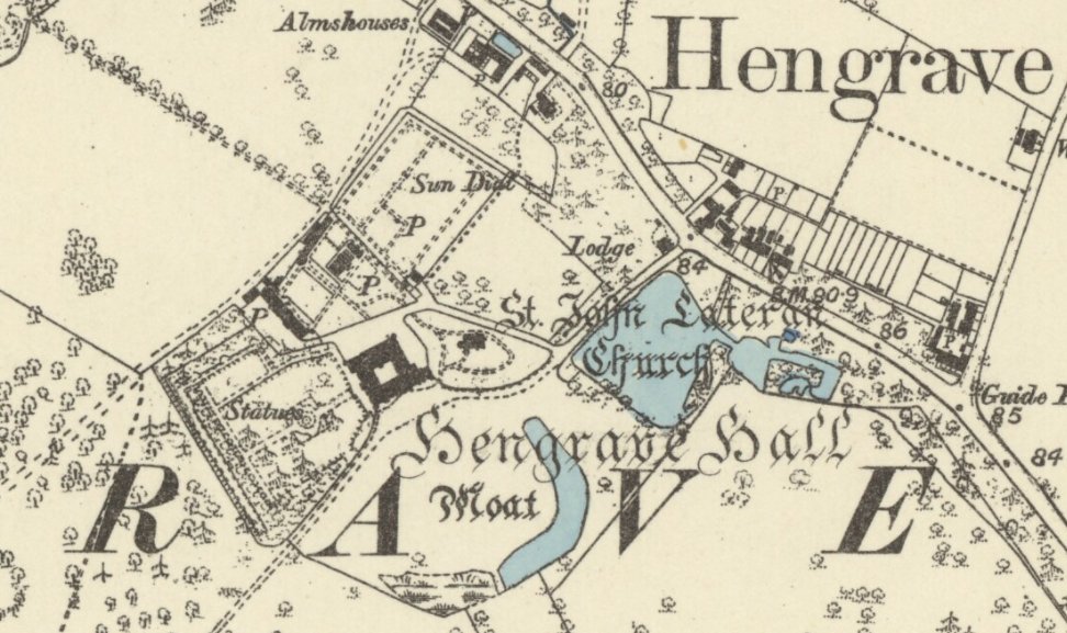
Shown on earlier maps to have been lost at the end of the eighteenth or beginning of the nineteenth century, by the time of the 1883 OS map the dramatic avenue running south-east from the house had been re-established and planted with lime trees and Cedar of Lebanon at the southern end. The short avenue north of the house leading to ‘Bath House Covert’ had survived at this time with a new canal-like feature established close to ‘Reed Pond’. A new track from the garden enclosure north of the house had been created towards ‘Stanshel’s Farm’ to the south-west and the southern track now branched off towards the forecourt of the house. At its southern end the ‘Keeper’s House’ had once more become a lodge. By this time the belt of trees surrounding the parkland was well-established and a number of additional trees had been planted, including two small woods towards the south-east end of the long avenue and a mixed planting of trees west of the Hall’s pleasure gardens. Obviously to commemorate the visit of Queen Elizabeth’s in 1578, an ancient oak tree beside ‘Stake Pond’ had been named ‘Queen Elizabeth’s Oak’ on the 1883 OS map.
Few changes were made in the parkland during the twentieth century, albeit a circular belt of trees surrounding ‘Stake Pond’ beside the south-east avenue had developed by 1905 and was likely the work of John Wood, as was the loss of the canal-like pond beside ‘Reed Pond’ which had gone by 1952. The area associated with the ancient park known as ‘Little Park’ is now the site of a large, new house and garden named ‘The Grove’.
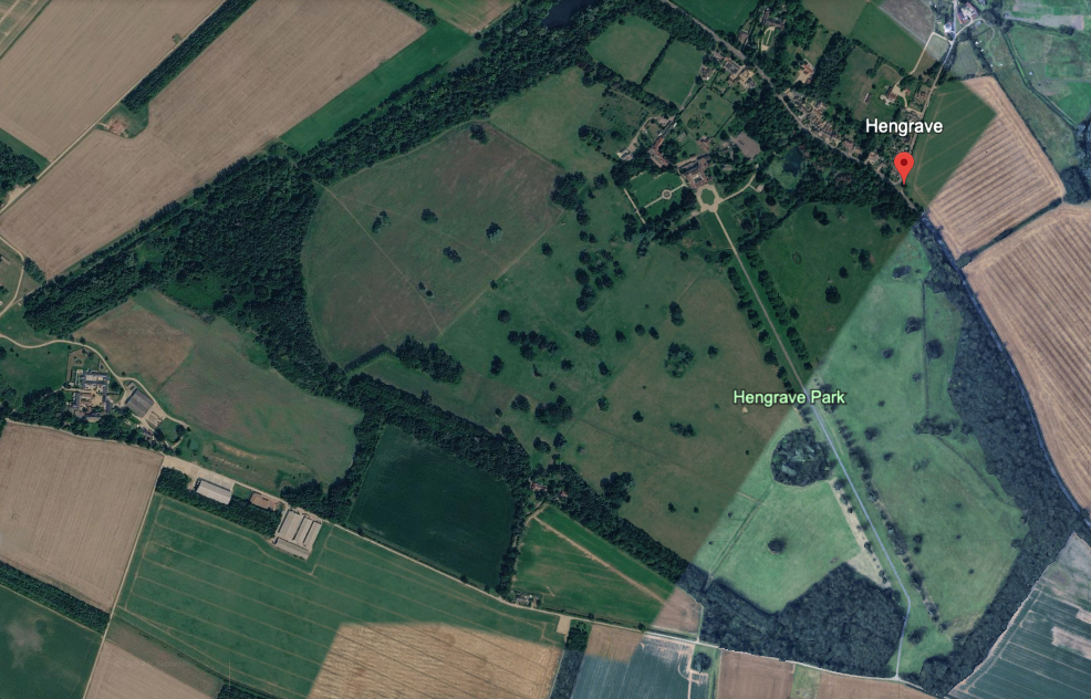
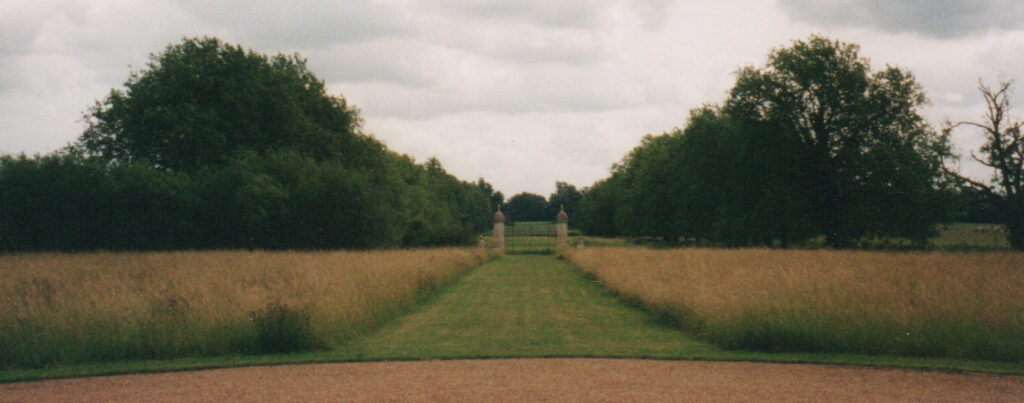
Since becoming a wedding and event venue the southern end of the main avenue has been curved and a new entrance drive created from a private road to the south. This new entrance is flanked by clumps of trees opening to a dramatic view along a re-established drive down to the entrance gate piers and house in the distance.
Today the extent of the parkland and its layout remain much as it was in the late-eighteenth century, albeit the pleasure gardens now encroach slightly into parkland north of the house.
PLEASURE GARDENS
By 1575 records of expenses show that formal Dutch-style gardens were being developed around the house with a formal knot garden, alleys and herbs surrounded by borders, probably in preparation for the visit of Queen Elizabeth three years later.
The 1588 map shows two formal oval ponds in an enclosure north of the house with open views of the northern park. From this enclosure an orchard lay to the west and one to the east with a square enclosure beyond, presumably the kitchen garden. South of the church there was a large pond with a serpentine avenue of trees leading to a square wooded area. This may have been the ‘wilderness’ referred to by John Gage in 1822, where winding paths would have weaved through it.
The 1742 map shows the kitchen garden and a ‘bowling garden’ with bowling green to the north of the house. To the west were ‘dovehouse yard’ and the stable yard, while south of the house the enclosure surrounded by the moat had become an ornate gated courtyard with a central circular feature, likely to be a lawn. The short serpentine avenue and square wood south of the church had gone by this time. Most of the features had changed little by the time the 1769 map was surveyed.
Richard Woods tended to concentrate his ideas on the grounds closest to the main house and those for Hengrave were no exception. His 1777 plans proposed combining the remains of the moat with the pond beside ‘dovehouse yard’, resulting in the yard becoming an island threaded with a winding path, shrubs and flowers. He also suggested the rectangular enclosures north of the house should be altered to give more flowing lines with curving paths and the north side of the kitchen garden should become curved with a building behind in a plantation. Around his plan Richard added drawings of features such as a Gothic temple, stone bridge, Chinese bridge and cascade plus elaborate garden bench. The 1816 survey of Hengrave Park suggests that none of his elaborate ideas for the gardens were implemented, except perhaps the curving of the lines of the western ‘dovehouse yard’ to create an oval garden.
Writing in 1822, John Gage refers to an ancient greengage tree in the garden at that time, which is believed to have been planted by Sir William Gage (1657–1727) 2nd Baronet of Hengrave, who is reputed to have introduced Grosse Reine Claude plum trees from Paris that were re-named the greengage. Depending on the source of information, this was either as a compliment to Sir William or because their labels were lost in transit so the head gardener named them greengages due to their colour when ripe.
The 1839 tithe map gives more detail and shows water channelled into the moat, then under the drive into two narrow curving ponds around the oval garden. Water then flowed into two ponds to the north of the house. From the eastern end of the moat a ditch carried water into the large pond beside the eastern drive named ‘Park Pond’, from where it fed into a further irregularly-shaped pond flanked by the boundary tree belt. Desilting of the east arm in 1992 uncovered brick walling and the sluice channel, possibly dating from the sixteenth century. The rectangular walled kitchen garden is shown with perimeter- and cross-paths with a freestanding building, possibly a glasshouse such as an orangery.
Estate accounts for the 1860s list a number of items directly related to the gardens including a revised plan for the west garden and upper terrace plus the purchase of many plants from a number of leading London nurseries, especially Lee, Waterer and Veitch.
An article in The Gardener’s Chronicle of 1881 refers to the flowers in the west garden of Hengrave Hall as ‘tastefully laid out’ in the fashionable geometric style. The article claimed that the gardens were designed by William Andrew Nesfield (1783–1881), one of the leading designers of the time, although there is no record of his involvement at Hengrave. However, a plan for a geometric garden dated July 1858 by James Howe survives in the extensive records of the Hengrave Collection. There are no known historic records of James as a landscape designer at the time, so it is possible he was an estate surveyor or the head gardener. It is conceivable that the plan records what was there at the time and not a plan for a future layout.
By 1883 the southern arm of the moat had dried-up and is marked on the OS map of that year as marsh land. As a consequence, the ponds surrounding the gardens to the west and north of the house appear to have disappeared. In the west garden this left surviving terraces to the north, east and west. A pre-1890 photograph from the Spanton Jarman Collection shows the west garden set out with the formal layout mainly laid to lawn. It had a wide central gravel path with cruciform layout and central flowerbed and statue. Urns and small upright cypress conifers were placed at the corners and flanking the path. Other earlier geometric flowerbeds were on either side, some covered in grass but still discernible and others lined with small bedding plants, suggestive of the period just before John Wood bought Hengrave in 1897, and very similar to that shown on the 1883 OS map.
At this time the north garden flanked by the stables was similarly set out in a geometric fashion with perimeter- and cross-paths and a freestanding building, possibly an orangery, in one quadrant.
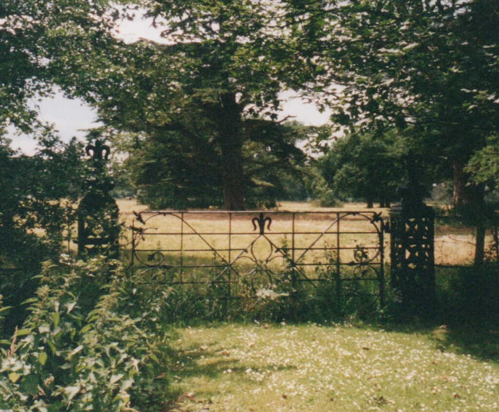
After buying Hengrave in 1897, John Wood’s work in the pleasure gardens appears to have mainly been replanting the west garden with bedding plants and roses on the earlier layout and altering an existing rose walk by adding many new rambler varieties. In addition, the layout of the north garden was ‘softened’ by reducing the paths and planting freestanding trees. Very soon after buying Hengrave John also added a surviving single storey garden room (Grade II) c. 9m (30ft) west of the house. It has a timber frame with brick-nogging and pantiled roof. Its oak joinery is believed to have been taken from early-sixteenth century features at Hengrave Hall when the house was being restored. Undated wrought iron gates, possibly added by John, lead from the west garden into parkland beyond. These are included in the Historic England listing of the house.
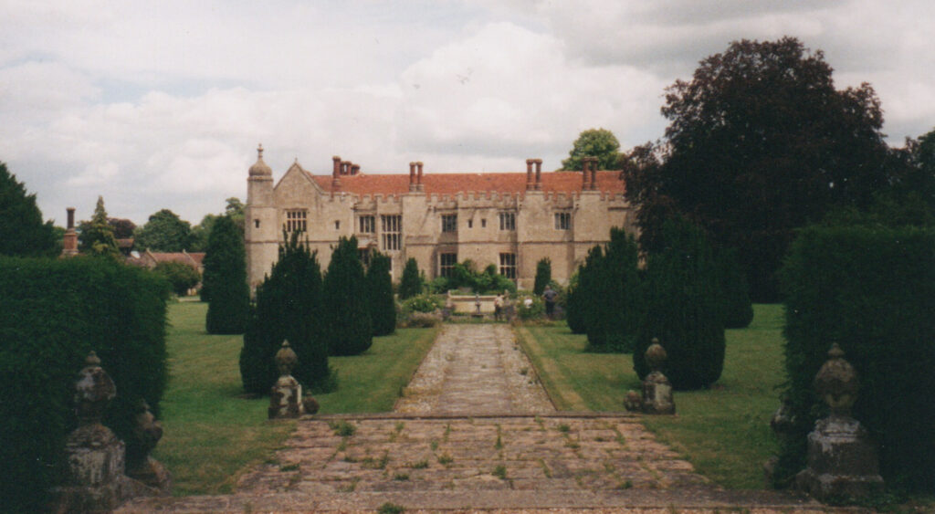
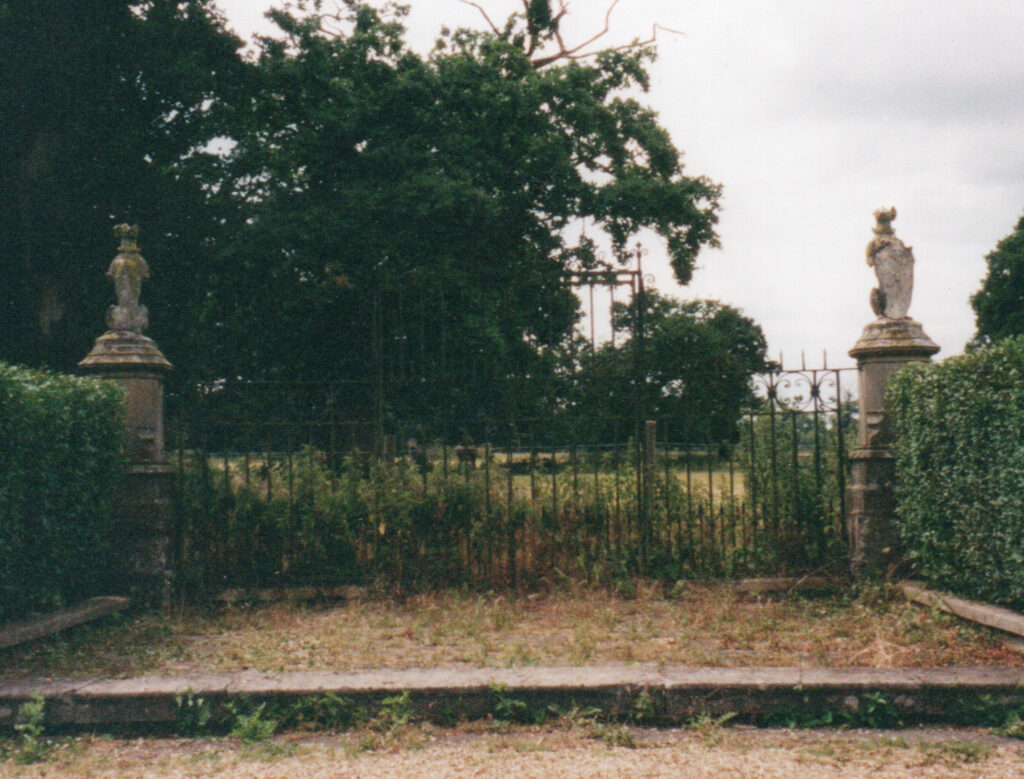
Few changes took place in the gardens during the twentieth century and it was not until it became a wedding and events venue that major work was undertaken. A car park has been developed beside the east drive, which arrives in front of the house as a geometric in-and-out drive with a central lawn and flowerbed. On either side there are clipped yew hedges. A grass meadow extends to the south within what was once the outer court bounded by the arms of the moat, although these are now overgrown with vegetation. Gate piers, iron gates and low flanking walls (Grade II) survive that were built c. 1850 to replace the earlier bridge between the original arms of the moat. On the east side of the south-east drive short avenues of pleached trees create a geometric pattern to the side of the grassed area.
The west garden is now mainly laid to lawn bounded by clipped hedges with a path on the central axis of the house, much as it was in the late-nineteenth century. This path leads to wide steps and a raised walkway from where there are views of, and access to, the parkland through wrought iron gateways. The late-nineteenth century cypresses have matured but are still clipped to shape.
The north garden now has a terrace with lawn bounded by trees and flowerbeds and opens out to the remains of the sixteenth century walled garden that incorporate eighteenth and nineteenth century walling. This is now laid to lawn with clumps of trees and incorporated into the pleasure gardens. Beyond the north garden the area has been planted with trees forming a ‘visual’ avenue leading out into the northern parkland, with narrow belts of trees enclosing the area.
SOURCES:
Barker, H. R., West Suffolk Illustrated, 1907.
Copinger, W. A., The Manors of Suffolk, Vol. 7, 1911.
Cowell, Fiona, Richard Woods (1715–1793). Master of the Pleasure Garden, 2009.
Cromwell, Thomas, Excursions in the County of Suffolk, Vol. 1, 1818.
Gage, John, The History and Antiquities of Hengrave in Suffolk, 1822.
Gage, John, The History and Antiquities of Suffolk. Thingeo Hundred, 1839.
The Gardener’s Chronicle, 1881.
Hoppitt, Rosemary, Deer Parks of Suffolk 1086–1602, 2020.
Williamson, Tom, Suffolk’s Gardens & Parks, 2000.
https://kids.kiddle.co/Mary_Darcy (accessed August 2026).
https://archiveshub.jisc.ac.uk/search/archives/2d95e640-23b2-3b1d-a224-3dedf5fb630c (accessed August 2026).
https://en.wikipedia.org/wiki/Religious_of_the_Assumption (accessed August 2026).
https://www.suffolkvillage.info/hengrave/ (accessed August 2026).
https://www.lib.cam.ac.uk/collections/departments/archives-modern-and-medieval-manuscripts-and-university-archives-10 (accessed July 2026).
http://www.stedmundsburychronicle.co.uk/riverlark/larkafter1600.htm (accessed November 2024).
http://www.stedmundsburychronicle.co.uk/Chronicle/1539-1699.htm (accessed August 2026).
https://www.burypastandpresent.org.uk/gallery-viewer/?ref=K505/1598 (accessed August 2026).
https://www.burypastandpresent.org.uk/
On-line talk by Edward Martin, January 2023.
Bury St Edmunds Past & Present Society, Spanton Jarman Collection ref: K505/2719.
Bury St Edmunds Past & Present Society, Spanton Jarman Collection ref: K505/1602.
Bury St Edmunds Past & Present Society, Spanton Jarman Collection ref: K505/1598.
Maps:
1588 Plan of Hengrave Park.
1742 Map surveyed for William Gage.
1769 Map of Hengrave Hall and Park.
1783 Hodskinson’s Map of Suffolk in 1783.
1816 Survey of Hengrave Park. (SA) 712/58.
1839 tithe map and apportionment.
1883 (surveyed 1882 to 1883) Ordnance Survey map.
1905 (revised 1903) OS map.
1952 (revised 1950) OS map.
Heritage Assets:
Suffolk Historic Environment Record (SHER) No: HNV 003, HNV 005, HNV 008, HNV 010, HNV 011, HNV 012, HNV 013, HNV 014, HNV 015, HNV 016, HNV 017, HNV 033, HNV 037, HNV 038, HNV 039, HNV 040, HNV 041, RBY 029.
Church of St. John Lateran (Grade I). Historic England No: 1180513.
Hengrave Hall (Grade I). Historic England No: 1031423.
Stable Block 20 yards west of Hengrave Hall (Grade II). Historic England No: 1285416.
Park Lodge (Grade II). Historic England No: 1031425.
The Lodge, Bury Road (Grade II). Historic England No: 1031426.
Entrance Gates, Piers and Railings at Hengrave Hall, Bury Road (Grade II). Historic England No: 1180627.
Bridge, Stonewall Piers and Iron Gates 150 yards south of Hengrave Hall (Grade II). Historic England No: 1031423.
Garden Room 10 yards west of Hengrave Hall (Grade II). Historic England No: 1376850.
Suffolk Archives (previously Suffolk Record Office):
(SA) P746/1. Photocopy of plan of Hengrave Park, 1588.
(SA) 712/58. Map surveyed for William Gage, 1742.
(SA) 712/60. Map of Hengrave Hall and Park, 1769.
(SA) 712/61. Survey of Hengrave Park, 1816.
Suffolk Archives 712/95/1-9.
Site ownership: Private
Study written: September 2026
Type of Study: Desktop/visit 2004.
Written by: Tina Ranft
Amended: